IMAGES TAKEN NEAR TO
Annable Road, MANCHESTER, M43 7FD
Introduction
This page details the photographs taken nearby to Annable Road, M43 7FD by members of the Geograph project.
The Geograph project started in 2005 with the aim of publishing, organising and preserving representative images for every square kilometre of Great Britain, Ireland and the Isle of Man.

There are currently over 7.5m images from over14,400 individuals and you can help contribute to the project by visiting https://www.geograph.org.uk
Image Map
Images are licensed for reuse under creativecommons.org/licenses/by-sa/2.0
Notes
- Clicking on the map will re-center to the selected point.
- The higher the marker number, the further away the image location is from the centre of the postcode.
Image Listing (45 Images Found)
Images are licensed for reuse under creativecommons.org/licenses/by-sa/2.0
Image
Details
Distance
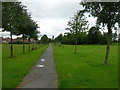
1
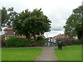
Pedestrian access to Annable Road
From Lees Park Droylsden.
Image: © John Topping
Taken: 10 Sep 2012
0.06 miles
2
Looking towards Oldham Street
From Lees Park Droylsden.
Image: © John Topping
Taken: 10 Sep 2012
0.07 miles
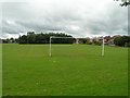
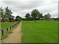
4
Path Alongside Leigh Drive, Droylsden
Looking to Lees Park playing field.
Image: © John Topping
Taken: 18 Jul 2012
0.08 miles
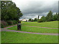
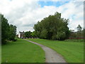
5
Path Heading Northwest Through Lees Park
Connecting path from Lynwood Grove to Oldham Street.
Image: © John Topping
Taken: 18 Jul 2012
0.11 miles
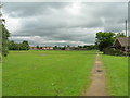
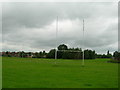
6
Path leading to Ashton Road, Droylsden
Southwest path through Lees Park, Fairlee Avenue on the left.
Image: © John Topping
Taken: 18 Jul 2012
0.11 miles
9
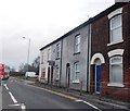
Terraced Housing, Market Street, Droylsden
Image: © Anthony Parkes
Taken: 14 Feb 2013
0.15 miles
10

Droylsden Medthodist Church
Droylsden Methodist Church is a new building opened in November 2008, and is situated on Dunkirk Street. The building was funded by Tameside Council following the compulsory purchase of the old Trinity building in the town centre. The congregations of Trinity and Moorside churches transferred into the building together, and were joined later by the congregation of Abbey Hey.
Image: © John Topping
Taken: 7 Jul 2012
0.15 miles