IMAGES TAKEN NEAR TO
Lines Road, MANCHESTER, M43 7FA

Introduction

This page details the photographs taken nearby to Lines Road, M43 7FA by members of the Geograph project.

The Geograph project started in 2005 with the aim of publishing, organising and preserving representative images for every square kilometre of Great Britain, Ireland and the Isle of Man.

There are currently over 7.5m images from over14,400 individuals and you can help contribute to the project by visiting https://www.geograph.org.uk

Image Map


Images are licensed for reuse under creativecommons.org/licenses/by-sa/2.0
Notes
  • Clicking on the map will re-center to the selected point.
  • The higher the marker number, the further away the image location is from the centre of the postcode.

Image Listing (155 Images Found)

Images are licensed for reuse under creativecommons.org/licenses/by-sa/2.0
  • ...
Image
Details
Distance
1
Droylsden, Baguley Street
Image: © David Dixon Taken: 14 Nov 2021
0.04 miles
2
Droylsden Methodist Church
The fairly austere appearance in 2013 has since been improved and the garden has become established. Meanwhile the church has been engaging in numerous community support activities.
Image: © Bill Boaden Taken: 9 Mar 2013
0.09 miles
3
Droylsden Medthodist Church
Droylsden Methodist Church is a new building opened in November 2008, and is situated on Dunkirk Street. The building was funded by Tameside Council following the compulsory purchase of the old Trinity building in the town centre. The congregations of Trinity and Moorside churches transferred into the building together, and were joined later by the congregation of Abbey Hey.
Image: © John Topping Taken: 7 Jul 2012
0.10 miles
4
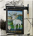
White Hart
The White Hart on Market Street is the second oldest pub in Droylsden dating from 1781. Image
Image: © Gerald England Taken: 12 Aug 2010
0.11 miles
5
Sign of the White Hart
Sign for the White Hart Image on Market Street.
Image: © Gerald England Taken: 12 Aug 2010
0.11 miles
6
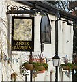
Moss Tavern sign
Pub sign and hanging baskets at the Moss Tavern Image Sign in 2010 from opposite direction: Image
Image: © Gerald England Taken: 1 Mar 2012
0.12 miles
7
Passageway between Tabley Gardens and Budworth Gardens
Leading to Redesmere Drive.
Image: © Gerald England Taken: 5 May 2015
0.12 miles
8
Ashton Road
The A662 with tramlines down the middle. Behind the large trees on the left is the site of the Moss Tavern Image which closed in 2013 and has since been demolished.
Image: © Gerald England Taken: 26 Apr 2019
0.12 miles
9
Site of former Moss Tavern
The site of the Moss Tavern Image which closed in 2013 and has since been demolished. Plans have been made to construct 23 dwellings on the site.
Image: © Gerald England Taken: 26 Apr 2019
0.12 miles
10
Bancroft Service Station, 17 Droylsden Road, Droylsden
This is a BP filling station, and Mace convenience store, with a car wash on the same site.
Image: © P L Chadwick Taken: 7 May 2011
0.12 miles
  • ...