IMAGES TAKEN NEAR TO
Browning Avenue, MANCHESTER, M43 6QG

Introduction

This page details the photographs taken nearby to Browning Avenue, M43 6QG by members of the Geograph project.

The Geograph project started in 2005 with the aim of publishing, organising and preserving representative images for every square kilometre of Great Britain, Ireland and the Isle of Man.

There are currently over 7.5m images from over14,400 individuals and you can help contribute to the project by visiting https://www.geograph.org.uk

Image Map


Images are licensed for reuse under creativecommons.org/licenses/by-sa/2.0
Notes
  • Clicking on the map will re-center to the selected point.
  • The higher the marker number, the further away the image location is from the centre of the postcode.

Image Listing (196 Images Found)

Images are licensed for reuse under creativecommons.org/licenses/by-sa/2.0
  • ...
Image
Details
Distance
1
Scott Road Rest Garden
A small memorial garden at the corner of Scott Road and Manchester Road. The plaque attached to the boulder reads: "In memory of those who gave their lives in war And in gratitude for the safe return of those who serve"
Image: © David Dixon Taken: 12 May 2021
0.04 miles
2
Droylsden South African War memorial
The memorial tablet has been incorporated into the fabric of the modern building. This picture http://www.geograph.org.uk/photo/3326341 shows the tablet in its context.
Image: © Alan Murray-Rust Taken: 7 Aug 2013
0.04 miles
3
Metrolink Tram on Manchester Road
Metrolink Bombardier M5000 tram number 3043 passes the Royal Oak pub on Manchester Road as it approaches Droylsden Tram Station. Although the line from Piccadilly to Droylsden wasn't officially opened until 11th February, this tram was operating as part of a free service as a "thank-you" to residents living next to the route (http://www.manchesterconfidential.co.uk/News/Droylsden-Metrolink-Route-Opening-Imminent Manchester Confidential). The new Droylsden Tram stop on Ashton Road will operate as the temporary terminus for the Metrolink East Manchester Line Extension which will eventually run to Ashton-Under-Lyne. http://www.lrta.org/Manchester/ashton.html LRT Association "Metrolink - Manchester to Droylsden and Ashton-Under-Lyne" http://www.metrolink.co.uk/futuremetrolink/Pages/east-manchester-line.aspx Transport for Greater Manchester - Metrolink East Manchester Line
Image: © David Dixon Taken: 9 Feb 2013
0.04 miles
4
Passing The Royal Oak
Metrolink tram on Manchester Road approaching Droylsden town centre.
Image: © Alan Murray-Rust Taken: 7 Aug 2013
0.04 miles
5
The Royal Oak
The Royal Oak public house on Manchester Road in Droylsden.
Image: © Peter McDermott Taken: 23 Apr 2016
0.04 miles
6
Manchester Road, Droylsden
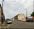
The A662 towards Manchester. On the right is the former Royal Oak Image
Image: © Gerald England Taken: 17 May 2019
0.04 miles
7
Abandoned pub
The old Royal Oak pub, now abandoned.
Image: © Paul Foster Taken: 16 Oct 2023
0.04 miles
8
The Royal Oak
Manchester Road, Droylsden. Open but for sale. Image
Image: © Gerald England Taken: 8 Aug 2015
0.05 miles
9
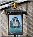
Sign of the Royal Oak
Sign for the Royal Oak Image
Image: © Gerald England Taken: 8 Aug 2015
0.05 miles
10
Police Station
Image: © Peter McDermott Taken: 18 Jun 2020
0.05 miles
  • ...