IMAGES TAKEN NEAR TO
De Brook Close, MANCHESTER, M41 6QH
Introduction
This page details the photographs taken nearby to De Brook Close, M41 6QH by members of the Geograph project.
The Geograph project started in 2005 with the aim of publishing, organising and preserving representative images for every square kilometre of Great Britain, Ireland and the Isle of Man.

There are currently over 7.5m images from over14,400 individuals and you can help contribute to the project by visiting https://www.geograph.org.uk
Image Map
Images are licensed for reuse under creativecommons.org/licenses/by-sa/2.0
Notes
- Clicking on the map will re-center to the selected point.
- The higher the marker number, the further away the image location is from the centre of the postcode.
Image Listing (31 Images Found)
Images are licensed for reuse under creativecommons.org/licenses/by-sa/2.0
Image
Details
Distance
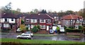
1
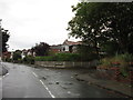
Woodsend Road South
Pedestrian walkway between Woodsend Road South and the bottom of Ambleside Road. (I think this is also Woodsend Road South).
Image: © Tony Lumb
Taken: 26 Dec 2004
0.03 miles
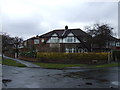
2
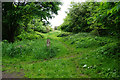
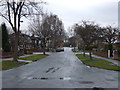
Crossing of footpaths near Flixton
Part of the green space near Flixton, which many of the local residents are concerned about protecting.
Image: © Bill Boaden
Taken: 22 May 2017
0.09 miles
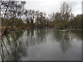
3
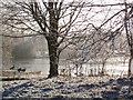
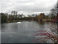
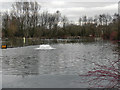
Duttons Pond
Quiet sunny Boxing Day walk near home.
Image: © Tony Lumb
Taken: 26 Dec 2004
0.12 miles