IMAGES TAKEN NEAR TO
Manchester Abattoir, Riverpark Road, MANCHESTER, M40 2XP

Introduction

This page details the photographs taken nearby to Manchester Abattoir, Riverpark Road, M40 2XP by members of the Geograph project.

The Geograph project started in 2005 with the aim of publishing, organising and preserving representative images for every square kilometre of Great Britain, Ireland and the Isle of Man.

There are currently over 7.5m images from over14,400 individuals and you can help contribute to the project by visiting https://www.geograph.org.uk

Image Map


Images are licensed for reuse under creativecommons.org/licenses/by-sa/2.0
Notes
  • Clicking on the map will re-center to the selected point.
  • The higher the marker number, the further away the image location is from the centre of the postcode.

Image Listing (14 Images Found)

Images are licensed for reuse under creativecommons.org/licenses/by-sa/2.0
Image
Details
Distance
1
Riverpark Business Centre
On Riverpark Road.
Image: © Mark Anderson Taken: 30 Oct 2023
0.07 miles
2
Park station 1989
Although the area was named for Victorian Philips Park, rapid industrialisation during the late 19th century led to Park station being situated odiferously between Manchester abattoir and various CWS food processing factories. As the area declined in the 1960s and 1970s, Park lost its raison d'etre. It had a skeletal service by 1989 and closed without fuss shortly afterwards.
Image: © Peter Whatley Taken: 11 Feb 1989
0.09 miles
3
Park station entrance 1989
Image: © Peter Whatley Taken: 11 Feb 1989
0.10 miles
4
Briscoe Lane Railway Bridge.
The bridge carrying the railway line over Briscoe Lane.
Image: © David Dixon Taken: 1 May 2010
0.11 miles
5
Low railway bridge over Briscoe Lane
Looking south west.
Image: © JThomas Taken: 25 Sep 2018
0.11 miles
6
The Manchester Abattoir
On Riverpark Road. Behind the wall on the left is Phillips Park Cemetery.
Image: © Bill Boaden Taken: 8 Jun 2010
0.11 miles
7
Bus stop on Briscoe Lane
Looking north east.
Image: © JThomas Taken: 25 Sep 2018
0.15 miles
8
Grimshaw Lane
Looking north west.
Image: © JThomas Taken: 25 Sep 2018
0.15 miles
9
River Medlock
The River Medlock in its man-made channel in Clayton Vale.
Image: © Peter McDermott Taken: 12 Jul 2020
0.15 miles
10
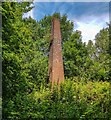
Chimney
The only remains of the Bank Bridge Works and Tannery in Clayton Vale.
Image: © Peter McDermott Taken: 12 Jul 2020
0.16 miles