IMAGES TAKEN NEAR TO
Aldred Street, MANCHESTER, M35 0AQ

Introduction

This page details the photographs taken nearby to Aldred Street, M35 0AQ by members of the Geograph project.

The Geograph project started in 2005 with the aim of publishing, organising and preserving representative images for every square kilometre of Great Britain, Ireland and the Isle of Man.

There are currently over 7.5m images from over14,400 individuals and you can help contribute to the project by visiting https://www.geograph.org.uk

Image Map


Images are licensed for reuse under creativecommons.org/licenses/by-sa/2.0
Notes
  • Clicking on the map will re-center to the selected point.
  • The higher the marker number, the further away the image location is from the centre of the postcode.

Image Listing (87 Images Found)

Images are licensed for reuse under creativecommons.org/licenses/by-sa/2.0
  • ...
Image
Details
Distance
1
Gerry Shields
Gerry Shields, a 'proper' bike shop in Failsworth.
Image: © Peter McDermott Taken: 27 Dec 2014
0.04 miles
2
Failsworth War Memorial Garden
The wall of the garden behind Image] carries the words: "THEY DIED IN MANY LANDS SO WE COULD LIVE HERE IN PEACE IN REMEMBRANCE OF ALL LIVES LOST IN CONFLICT" The plaque under the tiled Union Flag gives details of the re-dedication of the garden on 10th June 2007 by the Lord Lieutenant of Greater Manchester.
Image: © David Dixon Taken: 22 Jul 2012
0.05 miles
3
War Memorial and Memorial Garden, Failsworth
The front of the memorial simply carries the dates 1914, 1918. On the back of the memorial, and on the wall of the garden behind, are the words: "THEY DIED IN MANY LANDS SO WE COULD LIVE HERE IN PEACE" The date "2007" inlaid in the flagging, refers to the date the gardens were re-dedicated.
Image: © David Dixon Taken: 22 Jul 2012
0.05 miles
4
Bus on Old Road, Failsworth
The bus wears the 'Retro' livery of the North Western Road Car company, which went out of existence many years ago. Route 159 runs from Middleton to Oldham.
Image: © Dr Neil Clifton Taken: 2 Sep 2009
0.05 miles
5
The Brown Cow on Oldham Road
Image: © Ian S Taken: 3 Aug 2012
0.06 miles
6
The 'Foresters Arms', Oldham Road, Failsworth
On the main A62 linking Manchester with Oldham
Image: © Dr Neil Clifton Taken: 2 Sep 2009
0.06 miles
7
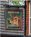
Sign of The Brown Cow
Sign for the Brown Cow Image
Image: © Gerald England Taken: 29 May 2021
0.06 miles
8
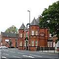
The Brown Cow
The Brown Cow was built in 1904 to replace an old beerhouse of the same name in a row of cottages along Oldham Road, Failsworth. In 1929 a wine license was granted and by the start of WWII it was under the ownership of Cornbrook Brewery. The brewery was taken over by Charrington United Breweries who later merged with Bass. Although it has retained its signage Image the pub was converted into residential use some years ago.
Image: © Gerald England Taken: 29 May 2021
0.06 miles
9
The 'Brown Cow', Oldham Road, Failsworth
This pub is on the north side of the A62, at the junction of Oldham Road with Old Road.
Image: © Dr Neil Clifton Taken: 2 Sep 2009
0.06 miles
10
Foresters Arms, Oldham Road
Image: © Alexander P Kapp Taken: 27 Jan 2009
0.07 miles
  • ...