IMAGES TAKEN NEAR TO
Oldham Road, MANCHESTER, M35 0AA

Introduction

This page details the photographs taken nearby to Oldham Road, M35 0AA by members of the Geograph project.

The Geograph project started in 2005 with the aim of publishing, organising and preserving representative images for every square kilometre of Great Britain, Ireland and the Isle of Man.

There are currently over 7.5m images from over14,400 individuals and you can help contribute to the project by visiting https://www.geograph.org.uk

Image Map


Images are licensed for reuse under creativecommons.org/licenses/by-sa/2.0
Notes
  • Clicking on the map will re-center to the selected point.
  • The higher the marker number, the further away the image location is from the centre of the postcode.

Image Listing (124 Images Found)

Images are licensed for reuse under creativecommons.org/licenses/by-sa/2.0
  • ...
Image
Details
Distance
1
Clock Tower and Pole, Failsworth, Oldham
This photograph shows the historic centre of Failsworth, the town that links Oldham to Manchester. There has been a maypole on this site for centuries. This one, on the clock tower was erected in 1958. In the background is the parish church, St John's. Taken from SD 897 017
Image: © Keith Williamson Taken: 20 Apr 2005
0.02 miles
2
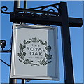
Sign for the Royal Oak, Failsworth
Image: © JThomas Taken: 10 Oct 2018
0.02 miles
3
Failsworth Pole
Failsworth Pole, on Oldham Road, is a major landmark of the area. It is believed that May Poles had been erected on this site for centuries before the first 'political pole' was erected in 1793. The pole and clock tower that now stands on the site is actually the fifth. It replaced the fourth one, erected in 1923 but blown down by a gale in 1950. (The second pole was erected in 1850, the third in 1889). See Image
Image: © David Dixon Taken: 27 Jan 2011
0.02 miles
4
Failsworth Pole (detail)
The information plaque on the side of Image
Image: © David Dixon Taken: 27 Jan 2011
0.02 miles
5
Failsworth Pole
Failsworth Pole, on Oldham Road, is a major landmark of the area. It is believed that May Poles had been erected on this site for centuries before the first 'political pole' was erected in 1793. The pole and clock tower that now stands on the site is actually the fifth. It replaced the fourth one, erected in 1923 but blown down by a gale in 1950. (The second pole was erected in 1850, the third in 1889). See Image
Image: © David Dixon Taken: 27 Jan 2011
0.02 miles
6
Failsworth Clock Tower
Image: © JThomas Taken: 10 Oct 2018
0.02 miles
7
Sign of the Royal Oak
Sign for the Royal Oak Image
Image: © Gerald England Taken: 13 Sep 2016
0.02 miles
8
Oldham Road and Failsworth Pole
The nominal heart of Failsworth, where a pole of one form or other has stood for over 200 years.
Image: © Bill Boaden Taken: 2 Jun 2010
0.02 miles
9
The Maypole Clock Tower - Failsworth
The clock tower was erected in 1958.
Image: © Anthony Parkes Taken: 25 Jun 2014
0.02 miles
10
The centre of Failsworth
The clock tower also known as the Failsworth Pole is considered to be the centre of Failsworth. On the right the A62 from Oldham to Manchester crosses the Rochdale Canal. On the left is the Royal Oak Image
Image: © Gerald England Taken: 13 Sep 2016
0.02 miles
  • ...