IMAGES TAKEN NEAR TO
Green End, MANCHESTER, M34 7PU
Introduction
This page details the photographs taken nearby to Green End, M34 7PU by members of the Geograph project.
The Geograph project started in 2005 with the aim of publishing, organising and preserving representative images for every square kilometre of Great Britain, Ireland and the Isle of Man.

There are currently over 7.5m images from over14,400 individuals and you can help contribute to the project by visiting https://www.geograph.org.uk
Image Map
Images are licensed for reuse under creativecommons.org/licenses/by-sa/2.0
Notes
- Clicking on the map will re-center to the selected point.
- The higher the marker number, the further away the image location is from the centre of the postcode.
Image Listing (79 Images Found)
Images are licensed for reuse under creativecommons.org/licenses/by-sa/2.0
Image
Details
Distance
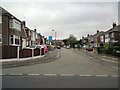
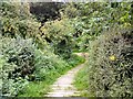
1
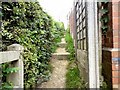
Footpath to Green End
From Haughton Dale.
Image: © Gerald England
Taken: 2 Sep 2013
0.05 miles
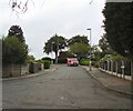
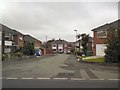
2
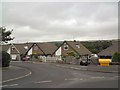
Green End
Off Riversmeed Road. The backs of the bungalows overlook Haughton Dale with Werneth Low on the horizon.
Image: © Gerald England
Taken: 2 Sep 2013
0.05 miles
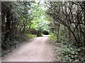
4
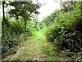
Haughton Dale
A footpath in Haughton Dale.
Image: © Gerald England
Taken: 2 Sep 2013
0.07 miles
5
Haughton Dale
A footpath in Haughton Dale.
Image: © Gerald England
Taken: 2 Sep 2013
0.07 miles
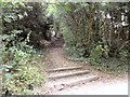
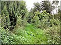
6
Steps in Haughton Dale
Leading from Green End towards the River Tame.
Image: © Gerald England
Taken: 2 Sep 2013
0.07 miles
7
Haughton Dale
A footpath in Haughton Dale.
Image: © Gerald England
Taken: 2 Sep 2013
0.08 miles