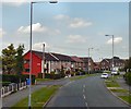
IMAGES TAKEN NEAR TO
Cemetery Road, MANCHESTER, M34 6ER

Introduction

This page details the photographs taken nearby to Cemetery Road, M34 6ER by members of the Geograph project.

The Geograph project started in 2005 with the aim of publishing, organising and preserving representative images for every square kilometre of Great Britain, Ireland and the Isle of Man.

There are currently over 7.5m images from over14,400 individuals and you can help contribute to the project by visiting https://www.geograph.org.uk

Image Map


Images are licensed for reuse under creativecommons.org/licenses/by-sa/2.0
Notes
  • Clicking on the map will re-center to the selected point.
  • The higher the marker number, the further away the image location is from the centre of the postcode.

Image Listing (8 Images Found)

Images are licensed for reuse under creativecommons.org/licenses/by-sa/2.0
Image
Details
Distance
1
Path between estates
This path links the older Corrie estate on Cemetery Road and westwards with the visible houses which form part of the former Manchester overspill Haughton Green Estate. To the left is the bottom of the playing field of Corrie Primary School.
Image: © Bill Boaden Taken: 17 May 2010
0.08 miles
2
Denton suburb
Main route between Denton and Bredbury. Grid square almost totally residential.
Image: © Dennis Turner Taken: 10 Oct 2005
0.10 miles
3
The Fletchers Arms
Image: © Anthony Parkes Taken: 6 Mar 2012
0.14 miles
4
Fletchers Arms
The Fletchers Arms public house on Stockport Road.
Image: © Peter McDermott Taken: 23 Aug 2014
0.14 miles
5
Fletchers Arms
Image: © Chris Morgan Taken: 23 Jun 2015
0.15 miles
6
Fletchers Arms
Large and popular pub/restaurant in Haughton Green
Image: © Graham Hogg Taken: 23 Jun 2015
0.15 miles
7
Lancaster Road
Passing Denbigh Road.
Image: © Gerald England Taken: 27 Jun 2011
0.19 miles
8
Footpath in Hardy Wood
This is right at the top end of the wood, not far from Mancunian Road.
Image: © Bill Boaden Taken: 17 May 2010
0.22 miles