IMAGES TAKEN NEAR TO
Merlyn Avenue, MANCHESTER, M34 6AL

Introduction

This page details the photographs taken nearby to Merlyn Avenue, M34 6AL by members of the Geograph project.

The Geograph project started in 2005 with the aim of publishing, organising and preserving representative images for every square kilometre of Great Britain, Ireland and the Isle of Man.

There are currently over 7.5m images from over14,400 individuals and you can help contribute to the project by visiting https://www.geograph.org.uk

Image Map


Images are licensed for reuse under creativecommons.org/licenses/by-sa/2.0
Notes
  • Clicking on the map will re-center to the selected point.
  • The higher the marker number, the further away the image location is from the centre of the postcode.

Image Listing (61 Images Found)

Images are licensed for reuse under creativecommons.org/licenses/by-sa/2.0
  • ...
Image
Details
Distance
1
Town Lane
Approaching Circular Road.
Image: © Gerald England Taken: 27 Jun 2011
0.06 miles
2
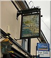
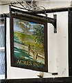
Sign for Acres Inn (South face)
The sign of the Acres Inn Image Image
Image: © Gerald England Taken: 5 Oct 2015
0.22 miles
3
Ruby Street
A street containing a lot of modern bungalows.
Image: © Gerald England Taken: 27 Jun 2011
0.23 miles
4
Sign for Acres Inn (North face)
The sign of the Acres Inn Image Image
Image: © Gerald England Taken: 5 Oct 2015
0.23 miles
5
Acres Inn
A pub for sale on Acre Street. Image Image
Image: © Gerald England Taken: 5 Oct 2015
0.23 miles
6
Acre Street
From the corner of Duke Street.
Image: © Gerald England Taken: 5 Dec 2011
0.23 miles
7
St Lawrence's churchyard
In the foreground is a stone mounting block which was once used to help people mount and dismount from their horses when they came to worship.
Image: © Gerald England Taken: 8 Sep 2016
0.23 miles
8
St Lawrence's churchyard
A nice display of flowers in the churchyard. In the foreground is a stone mounting block which was once used to help people mount and dismount from their horses when they came to worship. In the background is the Chapel House public house.
Image: © Gerald England Taken: 14 Mar 2017
0.23 miles
9
St Lawrence's Churchyard
Looking towards the lych gate and Town Lane. The gravestones are used as paving and most are extremely worn and almost impossible to read.
Image: © Gerald England Taken: 18 Jan 2016
0.23 miles
10
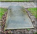
William and Peter Whitehead's grave
Most of the gravestones at St Lawrence's Church are well worn and difficult to read. This one appears to be in remembrance of William Whitehead who died in 1896 (?), also Peter Whitehead (died 1882 aged 70 years) and two others who died in the 1940s.
Image: © Gerald England Taken: 18 Jan 2016
0.24 miles
  • ...