IMAGES TAKEN NEAR TO
Heron Drive, MANCHESTER, M34 5QX
Introduction
This page details the photographs taken nearby to Heron Drive, M34 5QX by members of the Geograph project.
The Geograph project started in 2005 with the aim of publishing, organising and preserving representative images for every square kilometre of Great Britain, Ireland and the Isle of Man.

There are currently over 7.5m images from over14,400 individuals and you can help contribute to the project by visiting https://www.geograph.org.uk
Image Map
Images are licensed for reuse under creativecommons.org/licenses/by-sa/2.0
Notes
- Clicking on the map will re-center to the selected point.
- The higher the marker number, the further away the image location is from the centre of the postcode.
Image Listing (10 Images Found)
Images are licensed for reuse under creativecommons.org/licenses/by-sa/2.0
Image
Details
Distance
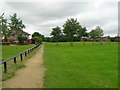
2
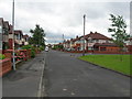
Lynwood Grove, Droylsden
Looking south from Lees Park, to the right is Fairlee Avenue.
Image: © John Topping
Taken: 18 Jul 2012
0.13 miles
3
Willow Walk leading to Cedar Drive
Lees Park, Droylsden.
Image: © John Topping
Taken: 18 Jul 2012
0.17 miles
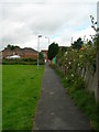
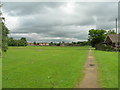
5
Path leading to Ashton Road, Droylsden
Southwest path through Lees Park, Fairlee Avenue on the left.
Image: © John Topping
Taken: 18 Jul 2012
0.18 miles
6
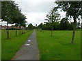
Path Heading Northwest Through Lees Park
Connecting path from Lynwood Grove to Oldham Street.
Image: © John Topping
Taken: 18 Jul 2012
0.19 miles
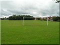
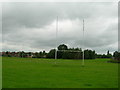
8
Path Alongside Leigh Drive, Droylsden
Looking to Lees Park playing field.
Image: © John Topping
Taken: 18 Jul 2012
0.22 miles
9

Warne Avenue Pedestrian Area
Looking southeast towards Audenshaw Junction on the former railway route from Droylsden Station Junction, which closed around 1970.
Image: © John Topping
Taken: 7 Jul 2012
0.23 miles
10
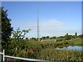
The Edge of Ashton Moss
A view to the northwest on the western edge of Ashton Moss in Audenshaw. SJ91759845.
Image: © Keith Williamson
Taken: 28 Sep 2005
0.25 miles