IMAGES TAKEN NEAR TO
Catherine Street West, MANCHESTER, M34 3SB

Introduction

This page details the photographs taken nearby to Catherine Street West, M34 3SB by members of the Geograph project.

The Geograph project started in 2005 with the aim of publishing, organising and preserving representative images for every square kilometre of Great Britain, Ireland and the Isle of Man.

There are currently over 7.5m images from over14,400 individuals and you can help contribute to the project by visiting https://www.geograph.org.uk

Image Map


Images are licensed for reuse under creativecommons.org/licenses/by-sa/2.0
Notes
  • Clicking on the map will re-center to the selected point.
  • The higher the marker number, the further away the image location is from the centre of the postcode.

Image Listing (133 Images Found)

Images are licensed for reuse under creativecommons.org/licenses/by-sa/2.0
  • ...
Image
Details
Distance
1
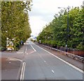
Manchester Road South
The A57 towards Manchester approaching the Denton Interchange. Manchester Road South (westbound) and Manchester Road North (eastbound) are separated by the M67 motorway between Seymour Street and the roundabout over the M60.
Image: © Gerald England Taken: 17 May 2010
0.02 miles
2
Moores Hat Factory
On Heaton Street and now occupied by a large variety of different businesses.
Image: © Gerald England Taken: 11 Sep 2009
0.05 miles
3
Catherine Street West
Looking towards Moore's Hat Factory.
Image: © Gerald England Taken: 9 Nov 2009
0.07 miles
4
Heaton Street
Sundome House on the corner of Derby Street and Heaton Street was a manufacturer of sunbeds but appears to be no longer trading. Heaton Street has been mostly subsumed by Manchester Road South which runs one way westwards parallel to the M67 motorway on the left.
Image: © Gerald England Taken: 15 Feb 2013
0.08 miles
5
Catherine Street West
Compare with a similar photo take in 2009 Image
Image: © Gerald England Taken: 16 Jun 2017
0.08 miles
6
Former Moore's Hat Factory
On Heaton Street. Viewed from the M67.
Image: © Chris Taken: 22 Apr 2013
0.09 miles
7
A green space
Off Catherine Street West.
Image: © Gerald England Taken: 16 Jun 2017
0.10 miles
8
Manchester Road North
The eastbound A57 alongside the M67 motorway on the right. The flashing sign on the motorway ahead warns of "Salt Spreading".
Image: © Gerald England Taken: 13 Feb 2016
0.10 miles
9
Heaton Street, Denton
Industrial units in the former Moores Hat Factory.
Image: © John Topping Taken: 28 Feb 2013
0.11 miles
10
Manchester Road South
A57 approaching Denton island. Sainsbury's supermarket lies to the left. The M67 motorway is on the right.
Image: © Gerald England Taken: 27 Jun 2011
0.11 miles
  • ...