IMAGES TAKEN NEAR TO
School Road, SALE, M33 7XB

Introduction

This page details the photographs taken nearby to School Road, M33 7XB by members of the Geograph project.

The Geograph project started in 2005 with the aim of publishing, organising and preserving representative images for every square kilometre of Great Britain, Ireland and the Isle of Man.

There are currently over 7.5m images from over14,400 individuals and you can help contribute to the project by visiting https://www.geograph.org.uk

Image Map


Images are licensed for reuse under creativecommons.org/licenses/by-sa/2.0
Notes
  • Clicking on the map will re-center to the selected point.
  • The higher the marker number, the further away the image location is from the centre of the postcode.

Image Listing (165 Images Found)

Images are licensed for reuse under creativecommons.org/licenses/by-sa/2.0
  • ...
Image
Details
Distance
1
School Road
Originally the main thoroughfare through the centre of Sale. Now pedestrianised.
Image: © Gerald England Taken: 30 Apr 2021
0.02 miles
2
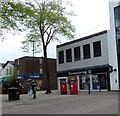
Superdrug and Greggs
Two shops on pedestrianised School Road, Sale. In front of Superdrug is a double-postbox (M33 827) and a box for franked mail.
Image: © Gerald England Taken: 30 Apr 2021
0.03 miles
3
Tim Horton's Coffee Shop, Sale
One of a number of cafes and restaurants along the pedestrianised School Road. A change of use for a nice old building which looks like it might have been a bank.
Image: © Des Blenkinsopp Taken: 29 Jun 2018
0.04 miles
4
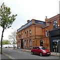
Bulls Head Hotel, Sale
The Bull's Head dates back to 1809. The inn is thought to have been named after the Massey family, the first 'lords of the manor' of Sale, as a bull's head was part of the family crest. The Public Health Acts of 1848 and 1875 ignited a nationwide movement to improve roads, drainage, and sewerage facilities. School Road was just a narrow lane in the 1800s. Keen to widen the thoroughfare, the Sale Local Board bought part of the Bull's Head property and then had it demolished to enable the widening of the road. George Hardy – of Hardy's, the local brewery company – purchased the land in 1878 and rebuilt the Bull's Head the following year, in the Victorian style in which we see it now following renovation in 1887. (Trafford Heritage: https://exploringtraffordsheritage.omeka.net/exhibits/show/trafford-pub-crawl/the-bulls-head-at-sale ) The pub is now a Craft Union Free House Image
Image: © Gerald England Taken: 30 Apr 2021
0.05 miles
5
Sign of the Bulls Head
Sign for the Bulls Head Image
Image: © Gerald England Taken: 30 Apr 2021
0.05 miles
6
Bull's Head Hotel, Sale
Built in 1879 with the date on the corner and was once owned by Hardy's Brewery. The Brewery History Society lists this as being in Cheadle Hulme, Manchester. The brewery was registered in May 1889, was acquired by United Breweries in 1962 and was demolished in 1965.
Image: © Des Blenkinsopp Taken: 29 Jun 2018
0.05 miles
7
#261 bus on Hayfield Street
The hourly service to Manor Avenue, Sale West at the terminus stop on Hayfield Street, the southbound loop of the B5166.
Image: © Gerald England Taken: 30 Apr 2021
0.05 miles
8
School Road, Sale
The main pedestrianised street in Sale town centre.
Image: © Richard Vince Taken: 12 Oct 2013
0.06 miles
9
Bean & Brush
Based in the old sorting office on Hayfield Street, Bean & Brush describes itself as a Family Art Cafe http://www.beanandbrush.co.uk/
Image: © Gerald England Taken: 30 Apr 2021
0.07 miles
10
Ashfield Road
Behind Ashfield Veterinary Surgery is Sainsbury's.
Image: © Gerald England Taken: 8 Apr 2017
0.09 miles
  • ...