IMAGES TAKEN NEAR TO
Washway Road, SALE, M33 4HA
Introduction
This page details the photographs taken nearby to Washway Road, M33 4HA by members of the Geograph project.
The Geograph project started in 2005 with the aim of publishing, organising and preserving representative images for every square kilometre of Great Britain, Ireland and the Isle of Man.

There are currently over 7.5m images from over14,400 individuals and you can help contribute to the project by visiting https://www.geograph.org.uk
Image Map
Images are licensed for reuse under creativecommons.org/licenses/by-sa/2.0
Notes
- Clicking on the map will re-center to the selected point.
- The higher the marker number, the further away the image location is from the centre of the postcode.
Image Listing (5 Images Found)
Images are licensed for reuse under creativecommons.org/licenses/by-sa/2.0
Image
Details
Distance
1
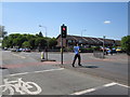
Washway Road/Woodhouse Lane junction, Sale
On the A56 heading towards Altrincham.
Image: © Peter Turner
Taken: 27 Apr 2011
0.05 miles
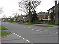
4
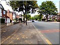
Washway Road
The A56 between Altrincham and Sale.
Image: © Gerald England
Taken: 26 Aug 2017
0.22 miles
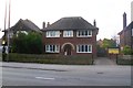
5
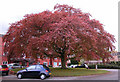
Copper Beech Tree, Woodhey Court, Alma Road, Sale
Image: © Andrew Huggett
Taken: 27 Apr 2002
0.23 miles