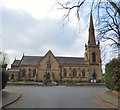
IMAGES TAKEN NEAR TO
Derbyshire Road, SALE, M33 3EG

Introduction

This page details the photographs taken nearby to Derbyshire Road, M33 3EG by members of the Geograph project.

The Geograph project started in 2005 with the aim of publishing, organising and preserving representative images for every square kilometre of Great Britain, Ireland and the Isle of Man.

There are currently over 7.5m images from over14,400 individuals and you can help contribute to the project by visiting https://www.geograph.org.uk

Image Map


Images are licensed for reuse under creativecommons.org/licenses/by-sa/2.0
Notes
  • Clicking on the map will re-center to the selected point.
  • The higher the marker number, the further away the image location is from the centre of the postcode.

Image Listing (53 Images Found)

Images are licensed for reuse under creativecommons.org/licenses/by-sa/2.0
  • ...
Image
Details
Distance
1
Artisan's cottages
Two of these are older than the third, and predate the late Victorian affluence of the rest of Sale.
Image: © Bob Harvey Taken: 22 Feb 2017
0.06 miles
2
Number 41 bus
Image: © Bob Harvey Taken: 22 Feb 2017
0.10 miles
3
Northenden Road (B5166), Sale
Image: © David Dixon Taken: 12 Jan 2012
0.11 miles
4
Ferrol Lodge
This large, well-built house is now a care home
Image: © Bob Harvey Taken: 22 Feb 2017
0.12 miles
5
Houses in Irlam Road
Image: © Bob Harvey Taken: 22 Feb 2017
0.12 miles
6
Parish Church of St Anne, Sale
St Anne’s Church, in Sale, was opened for worship in 1854. For more information, see the parish website http://www.stannesale.bravehost.com/
Image: © David Dixon Taken: 12 Jan 2012
0.13 miles
7
St Anne's Parish Church
St Anne’s Church, in Sale, was opened for worship in 1854. For more information, see the parish website http://www.stannesale.bravehost.com/ .
Image: © David Dixon Taken: 12 Jan 2012
0.13 miles
8
Northenden Road, Sale
Looking east from the junction with Woodlands Road, with an Arriva Manchester bus (probably a VDL SB200/Wrightbus Pulsar) at the head of a queue of traffic awaiting a green light.
Image: © Richard Vince Taken: 12 Oct 2013
0.13 miles
9
St Anne's Church
The Grade II listed https://historicengland.org.uk/listing/the-list/list-entry/1347890 church of St Anne was opened for worship in 1854. See parish website for more details. http://www.stannesale.bravehost.com/
Image: © Gerald England Taken: 30 Mar 2019
0.14 miles
10
St Anne's War Memorial
The Grade II listed https://historicengland.org.uk/listing/the-list/list-entry/1433672 war memorial in the grounds of St Anne's church was unveiled in 1920 by the Bishop of Chester. For more details see: St Anne's Church website: http://www.stannesale.bravehost.com/WarMemorial.html Imperial War Museum: https://www.iwm.org.uk/memorials/item/memorial/3189
Image: © Gerald England Taken: 30 Mar 2019
0.14 miles
  • ...