IMAGES TAKEN NEAR TO
Conway Road, SALE, M33 2TB

Introduction

This page details the photographs taken nearby to Conway Road, M33 2TB by members of the Geograph project.

The Geograph project started in 2005 with the aim of publishing, organising and preserving representative images for every square kilometre of Great Britain, Ireland and the Isle of Man.

There are currently over 7.5m images from over14,400 individuals and you can help contribute to the project by visiting https://www.geograph.org.uk

Image Map


Images are licensed for reuse under creativecommons.org/licenses/by-sa/2.0
Notes
  • Clicking on the map will re-center to the selected point.
  • The higher the marker number, the further away the image location is from the centre of the postcode.

Image Listing (14 Images Found)

Images are licensed for reuse under creativecommons.org/licenses/by-sa/2.0
Image
Details
Distance
1
Legh Arms
The Legh Arms is a Joseph Holts' pub http://www.joseph-holt.com/pubs/view/legh-arms When I took this photograph there was no signage visible although it appeared to be open for business. I think I may have caught it just before it was refurbished.
Image: © Gerald England Taken: 11 Mar 2017
0.12 miles
2
Car through shop window
Another shot of the car into Town and Country Carpet windows.
Image: © Paul Foster Taken: 26 Jan 2022
0.14 miles
3
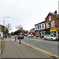
A6144
This picture was taken from SJ797913 looking Northeast along Marsland Road (A6144) towards Sale Moor.
Image: © Dave Smethurst Taken: 5 Sep 2005
0.14 miles
4
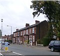
Houses on Marsland Road - Sale
Image: © Anthony Parkes Taken: 20 Sep 2015
0.14 miles
5
Car through shop window
Car accident. The vehicle was driven into the window of Town and Country Carpets
Image: © Paul Foster Taken: 26 Jan 2022
0.14 miles
6
Sign of the Temple Inn
The sign for the Temple Inn on Northenden Road Image according to which it is a Craft Union Free House.
Image: © Gerald England Taken: 11 Mar 2017
0.19 miles
7
Northenden Road, Sale Moor
The B5166 at Sale Moor. On one side of Temple Road is a Texaco garage and on the other side is The Temple Inn which according to its sign Image is a Craft Union Free House. At one time it had been a John Smiths house.
Image: © Gerald England Taken: 11 Mar 2017
0.20 miles
8
Welding firm, Sale Moor
A gently decaying shed on a traffic island at the junction of Baguley Road and New Hall Road.
Image: © Derek Harper Taken: 20 Aug 2010
0.21 miles
9
Path, Moor Nook Playing Field
Here passing the pavilion, the path links Derbyshire Road South with Norris Road.
Image: © Derek Harper Taken: 20 Aug 2010
0.21 miles
10
Former Trinity Chapel
The former chapel on Northenden Road. Originally built in 1875, it is now converted into offices. See also Image
Image: © David Dixon Taken: 12 Jan 2012
0.24 miles