IMAGES TAKEN NEAR TO
Grosvenor Street, MANCHESTER, M32 8BR

Introduction

This page details the photographs taken nearby to Grosvenor Street, M32 8BR by members of the Geograph project.

The Geograph project started in 2005 with the aim of publishing, organising and preserving representative images for every square kilometre of Great Britain, Ireland and the Isle of Man.

There are currently over 7.5m images from over14,400 individuals and you can help contribute to the project by visiting https://www.geograph.org.uk

Image Map


Images are licensed for reuse under creativecommons.org/licenses/by-sa/2.0
Notes
  • Clicking on the map will re-center to the selected point.
  • The higher the marker number, the further away the image location is from the centre of the postcode.

Image Listing (89 Images Found)

Images are licensed for reuse under creativecommons.org/licenses/by-sa/2.0
  • ...
Image
Details
Distance
1
Chester Road
Buildings on Chester Road.
Image: © Peter McDermott Taken: 22 Apr 2017
0.12 miles
2
"For sale or long lease"
Formerly Stretford Public Hall
Image: © Ian Greig Taken: 11 Jul 2014
0.12 miles
3
Stretford Public Hall
On Chester Road; built in 1879 by Manchester benefactor John Rylands as free library, lecture rooms & hall. English Heritage-listed, http://www.imagesofengland.org.uk/Details/Default.aspx?id=212970&mode=adv
Image: © Mike Faherty Taken: 17 May 2009
0.13 miles
4
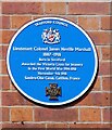
Lieutenant Colonel James Neville Marshall
The blue plaque on Stretford Public Hall Image reads: TRAFFORD COUNCIL Lieutenant Colonel James Neville Marshall 1887-1918 Born in Stretford Awarded the Victoria Cross for bravery in the First World War 1914-1918 November 4th 1918 Sambre-Oise Canal, Catillon, France
Image: © Gerald England Taken: 30 Apr 2022
0.13 miles
5
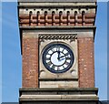
Stretford Public Hall clock
Clock on Stretford Public Hall Image
Image: © Gerald England Taken: 30 Apr 2022
0.13 miles
6
Stretford Public Hall
The Grade II listed building https://historicengland.org.uk/listing/the-list/list-entry/1067873?section=official-list-entry was built by the philanthropists John and Enriquetta Rylands in 1878. John Rylands was Manchester's first multi-millionaire, who made his money from textile mills. The Hall was designed by architect N. Lofthouse in a mixed gothic revival style. It was intended to be a public hall, with lecture rooms and the town's first free lending library. Following John Ryland's death in 1888, his widow Enriqueta rented the building to the local authority. The hall became known as Stretford Town Hall. In 1910, the Hall was bought by Stretford Council for a nominal fee of £5,000. In 1940, the new Stretford Library was opened on King Street and Stretford Public Hall's library was no longer needed, leading to the hall's closure. The building re-opened in March 1949 as the Stretford Civic Theatre. In December 1977, the theatre secured its place in local music history when it hosted the Rock against Racism Christmas Party, featuring John Cooper Clarke, The Worst and The Fall. However the Hall later fell into disrepair and eventually, Trafford Council refurbished and converted it to serve as council offices in the mid-1990s. It was re-opened in 1997, once again named Stretford Public Hall. The hall is now run by Friends of Stretford Public Hall, who have owned the building since a community asset transfer in 2015. They are a charitable Community Benefit Society with over 800 members. They provide accessible community space and deliver a programme of events and activities, including arts activities, live music nights, community cinema, and health and wellbeing activities. Stretford Public Hall website: https://stretfordpublichall.org.uk/ A Ukrainian flag is currently flying outside.
Image: © Gerald England Taken: 30 Apr 2022
0.13 miles
7
Stretford Public Hall
Stretford Public Hall was built by John Rylands, a local philanthropist, aka “The Cotton King” and Manchester’s first multi-millionaire. It stands on the corner of Chester Road and Dorset Street, and is commonly (but wrongly) assumed to be Stretford Town Hall (which is a separate building now known as Trafford Town Hall).
Image: © Steven Haslington Taken: 20 Jul 2014
0.13 miles
8
Kingsway, Stretford
The A5145 at Stretford.
Image: © Gerald England Taken: 17 Sep 2016
0.14 miles
9
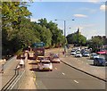
Chester Road
The A56 through Stretford. The roof of Old Trafford football stadium is visible in the background.
Image: © Gerald England Taken: 30 Apr 2022
0.14 miles
10
The Stretford Public Hall on Chester Road
Image: © Ian S Taken: 3 Aug 2012
0.14 miles
  • ...