IMAGES TAKEN NEAR TO
Derbyshire Lane, MANCHESTER, M32 8BN
Introduction
This page details the photographs taken nearby to Derbyshire Lane, M32 8BN by members of the Geograph project.
The Geograph project started in 2005 with the aim of publishing, organising and preserving representative images for every square kilometre of Great Britain, Ireland and the Isle of Man.

There are currently over 7.5m images from over14,400 individuals and you can help contribute to the project by visiting https://www.geograph.org.uk
Image Map
Images are licensed for reuse under creativecommons.org/licenses/by-sa/2.0
Notes
- Clicking on the map will re-center to the selected point.
- The higher the marker number, the further away the image location is from the centre of the postcode.
Image Listing (22 Images Found)
Images are licensed for reuse under creativecommons.org/licenses/by-sa/2.0
Image
Details
Distance
4
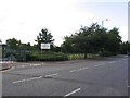
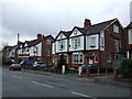
Victoria Park Junior School
This is the entrance gate for Victoria Park Junior School on Davyhulme Road East, Stretford at SJ799949.
Image: © Dave Smethurst
Taken: 17 Jul 2005
0.18 miles
5
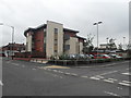
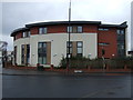
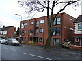
The Bowling Green Apartments - Stretford
Image: © Anthony Parkes
Taken: 22 Jul 2010
0.18 miles
6
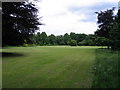
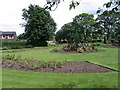
Victoria's Lawn
Victoria Park Stretford.
Image: © David Newton
Taken: 9 Jun 2009
0.19 miles
8
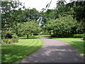
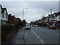
Victoria Park
Entrance to the park from Barton Rd.
Image: © David Newton
Taken: 9 Jun 2009
0.19 miles
10
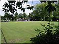
Game on
The bowling green, Victoria Park, Stretford.
Image: © David Newton
Taken: 9 Jun 2009
0.20 miles