IMAGES TAKEN NEAR TO
Mary Street, MANCHESTER, M3 1NH
Introduction
This page details the photographs taken nearby to Mary Street, M3 1NH by members of the Geograph project.
The Geograph project started in 2005 with the aim of publishing, organising and preserving representative images for every square kilometre of Great Britain, Ireland and the Isle of Man.

There are currently over 7.5m images from over14,400 individuals and you can help contribute to the project by visiting https://www.geograph.org.uk
Image Map
Images are licensed for reuse under creativecommons.org/licenses/by-sa/2.0
Notes
- Clicking on the map will re-center to the selected point.
- The higher the marker number, the further away the image location is from the centre of the postcode.
Image Listing (161 Images Found)
Images are licensed for reuse under creativecommons.org/licenses/by-sa/2.0
Image
Details
Distance
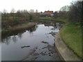
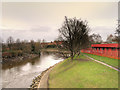
3
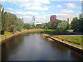
River Irwell
Downstream from the Cottenham Lane bridge.
Image: © David Dixon
Taken: 24 Jun 2010
0.03 miles
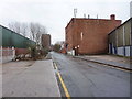
8
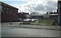
Langston Street
Off Great Ducie Street, Strangeways.
Image: © Gerald England
Taken: 13 Sep 2011
0.09 miles
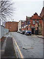
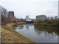
9
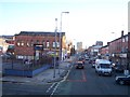
Great Ducie Street at Strangeways
Ferris wheel in Manchester city centre can be seen in distance
Image: © Raymond Knapman
Taken: 26 Jan 2012
0.09 miles
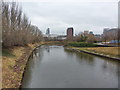
10
River Irwell, Salford
Looking upstream from Trinity Way.
Image: © David Dixon
Taken: 29 Jan 2016
0.09 miles