IMAGES TAKEN NEAR TO
Isherwood Road, MANCHESTER, M31 4RA
Introduction
This page details the photographs taken nearby to Isherwood Road, M31 4RA by members of the Geograph project.
The Geograph project started in 2005 with the aim of publishing, organising and preserving representative images for every square kilometre of Great Britain, Ireland and the Isle of Man.

There are currently over 7.5m images from over14,400 individuals and you can help contribute to the project by visiting https://www.geograph.org.uk
Image Map
Images are licensed for reuse under creativecommons.org/licenses/by-sa/2.0
Notes
- Clicking on the map will re-center to the selected point.
- The higher the marker number, the further away the image location is from the centre of the postcode.
Image Listing (10 Images Found)
Images are licensed for reuse under creativecommons.org/licenses/by-sa/2.0
Image
Details
Distance
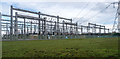
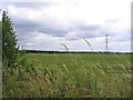
1
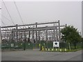
It's all about Power!
Daines substation on Carrington Moss. SJ74749228
Image: © Keith Williamson
Taken: 6 Sep 2005
0.08 miles
2
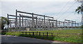
Electricity substation, Carrington
Impressive in its own way. I feel I should understand what goes on here, but it doesn't make it so.
Image: © Stephen Richards
Taken: 25 Jul 2011
0.13 miles
3
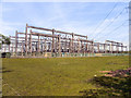
Daines Electricity Substation
The electricity sub-station on Carrington Moss, at the end of Isherwood Road.
Image: © David Dixon
Taken: 20 Apr 2011
0.14 miles
4
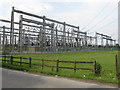
Power To The People!
The extremely important switching station at Carrington, at the end of Ackers Lane. Makes attempts at urban sculpture look puny!
Image: © Peter Whatley
Taken: 1 Jul 2009
0.16 miles
5
Carrington Moss
Electricity sub-station on Carrington Moss.
Image: © Peter McDermott
Taken: 11 Oct 2014
0.16 miles
6
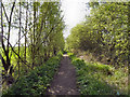
North Road, Carrington Moss
Although marked as "North Road" on the map, this is just a track, barely wide enough for a single person.
Image: © David Dixon
Taken: 20 Apr 2011
0.17 miles
7
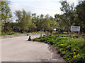
Access Barrier, Birch Road
The barrier controls vehicular access to Birch Road (leading to the Manchester United training facilities) on Carrington Moss.
Image: © David Dixon
Taken: 20 Apr 2011
0.18 miles
8
North Road, Carrington Moss
Although marked as "North Road" on the map, this is just a track, barely wide enough for a single person.
Image: © David Dixon
Taken: 20 Apr 2011
0.22 miles
9
Pasture land south from SJ746918
This is the view south from the footpath. I was going to photograph the water behind where I was stood but there was a fence and shrubbery and it could not be seen, sorry but the field will have to do.
Image: © Dave Smethurst
Taken: 6 Aug 2005
0.23 miles
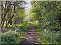
10
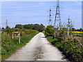
Path on Carrington Moss
The path from Isherwood Road.
Image: © David Dixon
Taken: 20 Apr 2011
0.24 miles