IMAGES TAKEN NEAR TO
Manchester Road, MANCHESTER, M31 4QR
Introduction
This page details the photographs taken nearby to Manchester Road, M31 4QR by members of the Geograph project.
The Geograph project started in 2005 with the aim of publishing, organising and preserving representative images for every square kilometre of Great Britain, Ireland and the Isle of Man.

There are currently over 7.5m images from over14,400 individuals and you can help contribute to the project by visiting https://www.geograph.org.uk
Image Map
Images are licensed for reuse under creativecommons.org/licenses/by-sa/2.0
Notes
- Clicking on the map will re-center to the selected point.
- The higher the marker number, the further away the image location is from the centre of the postcode.
Image Listing (11 Images Found)
Images are licensed for reuse under creativecommons.org/licenses/by-sa/2.0
Image
Details
Distance
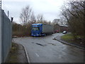
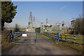
1
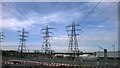
Carrington Power Station, Carrington, Lancashire
Image: © Benjamin Shaw
Taken: 5 Oct 2014
0.07 miles
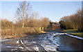
2
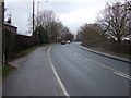
Carrington - Manchester Road, Old Alignment
Image: © Peter Whatley
Taken: 3 Jun 2009
0.10 miles
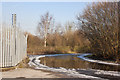
3
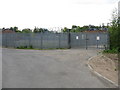
Electricity Switching Station, Carrington
Image: © Peter Whatley
Taken: 3 Jun 2009
0.10 miles
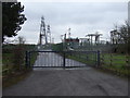
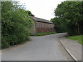
5
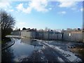
Flooded Road near the Electricity Station - Carrington
Image: © Anthony Parkes
Taken: 1 Feb 2012
0.12 miles