1
St Mary's Parish Church, Partington
The church of St Mary the Virgin is the parish church for Partington and Carrington. It dates from 1883 and is Grade II listed https://historicengland.org.uk/listing/the-list/list-entry/1389141 It lies on the A6144 Manchester Road.
Image: © Gerald England
Taken: 16 Apr 2021
0.08 miles
2
St Mary's Church, Partington
Image: © JThomas
Taken: 9 Mar 2013
0.08 miles
3
St Mary's Church - Partington
Image: © Anthony Parkes
Taken: 22 Mar 2012
0.08 miles
4
St Mary the Virgin, Partington
St Mary's Church on Manchester Road is the parish church for Partington and Carrington. Founded in 1884, it is a Grade II listed building.
http://www.stmaryspartington.org.uk/ - church web site
Image: © David Dixon
Taken: 20 Apr 2011
0.08 miles
5
St Mary's Parish Church, Partington
The church of St Mary the Virgin is the parish church for Partington and Carrington. It was founded in 1884, and is a Grade II listed building.
http://www.stmaryspartington.org.uk/ St Mary's Church web site.
Image: © David Dixon
Taken: 20 Apr 2011
0.08 miles
6
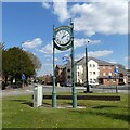
Clock at road junction near St Mary's Church Partington
The clock was put up in the year 2000 like many others throughout the country.
Image: © R Greenhalgh
Taken: 20 Jun 2007
0.09 miles
7
Partington Millennium Clock
Image: © Gerald England
Taken: 16 Apr 2021
0.09 miles
8
Partington
The junction of Manchester Road, Manchester New Road and Moss Lane.
Image] is to the left, whilst
Image] is ahead.
Image: © David Dixon
Taken: 20 Apr 2011
0.10 miles
9
Partington Millennium Clock
The Millennium clock in Partington. Erected in 2000, at the junction of Manchester Road, Manchester New Road and Moss Lane, at the centre of the village.
Image: © David Dixon
Taken: 20 Apr 2011
0.10 miles
10
Partington Millennium Clock
The clock erected in 2000 stands on a triangle of grass at the corner of Manchester Road and Manchester New Road. Behind it used to be the Greyhound pub. That was demolished many years ago and the site is earmarked for housing. In the background is an electricity sub station. One of the lamps in the foreground carries a flag featuring a rainbow and the words Thank you NHS.
Image: © Gerald England
Taken: 16 Apr 2021
0.10 miles


