IMAGES TAKEN NEAR TO
Meadowgrass Gardens, MANCHESTER, M28 1PS
Introduction
This page details the photographs taken nearby to Meadowgrass Gardens, M28 1PS by members of the Geograph project.
The Geograph project started in 2005 with the aim of publishing, organising and preserving representative images for every square kilometre of Great Britain, Ireland and the Isle of Man.

There are currently over 7.5m images from over14,400 individuals and you can help contribute to the project by visiting https://www.geograph.org.uk
Image Map
Images are licensed for reuse under creativecommons.org/licenses/by-sa/2.0
Notes
- Clicking on the map will re-center to the selected point.
- The higher the marker number, the further away the image location is from the centre of the postcode.
Image Listing (14 Images Found)
Images are licensed for reuse under creativecommons.org/licenses/by-sa/2.0
Image
Details
Distance
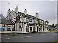
4
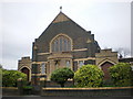
Church of the Holy Family, Boothstown
Image: © Alexander P Kapp
Taken: 16 Dec 2009
0.17 miles
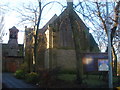
5
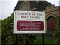
Church of the Holy Family, Boothstown, Sign
Image: © Alexander P Kapp
Taken: 16 Dec 2009
0.18 miles
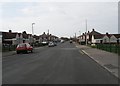
6
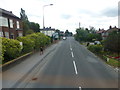
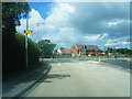
Chaddock Lane near the crossing of East Lancs Road
Image: © Raymond Knapman
Taken: 5 Aug 2014
0.19 miles
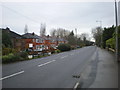
9
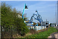
A Martian invasion...
...or cherry pickers?
Image: © Ian Greig
Taken: 10 Apr 2010
0.21 miles