IMAGES TAKEN NEAR TO
West Vale, MANCHESTER, M26 4FG
Introduction
This page details the photographs taken nearby to West Vale, M26 4FG by members of the Geograph project.
The Geograph project started in 2005 with the aim of publishing, organising and preserving representative images for every square kilometre of Great Britain, Ireland and the Isle of Man.

There are currently over 7.5m images from over14,400 individuals and you can help contribute to the project by visiting https://www.geograph.org.uk
Image Map
Images are licensed for reuse under creativecommons.org/licenses/by-sa/2.0
Notes
- Clicking on the map will re-center to the selected point.
- The higher the marker number, the further away the image location is from the centre of the postcode.
Image Listing (59 Images Found)
Images are licensed for reuse under creativecommons.org/licenses/by-sa/2.0
Image
Details
Distance
1
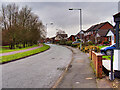
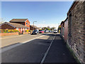
Radcliffe, Greenbank Road
Part of a 1990s residential development, Greenbank Road follows the route of the former Lancashire and Yorkshire Railway's line which closed ca1970.
Image: © David Dixon
Taken: 27 Jan 2021
0.04 miles
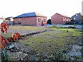
2
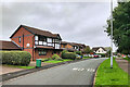
Greenbank Road
Part of a housing development from the 1990s.
Image: © David Dixon
Taken: 18 Aug 2021
0.06 miles
3
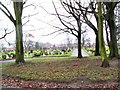
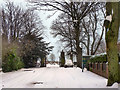
Radcliffe Cemetery
Looking south-west across the cemetery towards the main gate.
Image: © Roger May
Taken: 21 Dec 2005
0.10 miles
6
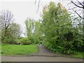
Cycle path following route of former railway
Following the former Bolton to Radcliffe line at the crossing with Cemetery Road
Image: © Kevin Waterhouse
Taken: 28 Apr 2023
0.13 miles
7
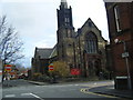
Wesleyan Methodist Church, Ainsworth Road
Image: © Colin Pyle
Taken: 20 Nov 2009
0.13 miles
8
Wesleyan Methodist Church, Radcliffe
Image: © Alexander P Kapp
Taken: 21 Oct 2005
0.13 miles
9
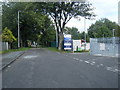
Cemetery Road
Looking along Cemetery Road towards the entrance to Radcliffe Cemetery and the East Lancashire Crematorium.
Image: © David Dixon
Taken: 5 Feb 2012
0.13 miles
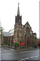
10
Wesley Methodist Church, Ainsworth Road
Following the demolition of the older church, earlier in 2013 - Image], the congregation now meets in this simpler, modern building.
Image: © David Dixon
Taken: 25 Nov 2013
0.14 miles