IMAGES TAKEN NEAR TO
Earls Close, MANCHESTER, M26 3DF
Introduction
This page details the photographs taken nearby to Earls Close, M26 3DF by members of the Geograph project.
The Geograph project started in 2005 with the aim of publishing, organising and preserving representative images for every square kilometre of Great Britain, Ireland and the Isle of Man.

There are currently over 7.5m images from over14,400 individuals and you can help contribute to the project by visiting https://www.geograph.org.uk
Image Map
Images are licensed for reuse under creativecommons.org/licenses/by-sa/2.0
Notes
- Clicking on the map will re-center to the selected point.
- The higher the marker number, the further away the image location is from the centre of the postcode.
Image Listing (11 Images Found)
Images are licensed for reuse under creativecommons.org/licenses/by-sa/2.0
Image
Details
Distance
1
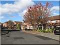
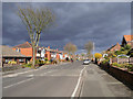
Westminster Avenue
Part of the Bolton Road Estate.
Image: © Jonathan Wilkins
Taken: 23 Oct 2016
0.06 miles
3
Trinity Baptist Church
Trinity Baptist Church on Westminster Avenue.
Image: © David Dixon
Taken: 26 Jul 2020
0.13 miles
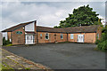
5
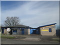
Coronation Road Community Centre and Library
Image: © John Slater
Taken: 10 Apr 2016
0.14 miles
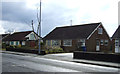
6
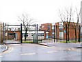
Radcliffe Primary School
Gates closed and locked - School's out! The Christmas holidays have just begun.
Image: © Roger May
Taken: 21 Dec 2005
0.17 miles
7
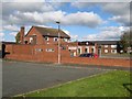
Wilton Arms
A modern public house on the Bolton Road Estate, near to the junction of Coronation Road with Gingham Park. There are also some shops here.
Image: © Jonathan Wilkins
Taken: 23 Oct 2016
0.18 miles
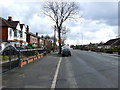
8
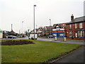
Black Moss
The mini roundabout where the A665, Bolton Road, changes into Countess Lane. To the left the A6053, Stopes Road joins from Little Lever.
Image: © David Dixon
Taken: 7 Feb 2010
0.18 miles
10
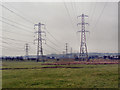
Electricity power lines
Overhead power lines crossing pasture land north of Stopes Road
Image: © David Dixon
Taken: 7 Feb 2010
0.25 miles