IMAGES TAKEN NEAR TO
Hindle Street, MANCHESTER, M26 3AH
Introduction
This page details the photographs taken nearby to Hindle Street, M26 3AH by members of the Geograph project.
The Geograph project started in 2005 with the aim of publishing, organising and preserving representative images for every square kilometre of Great Britain, Ireland and the Isle of Man.

There are currently over 7.5m images from over14,400 individuals and you can help contribute to the project by visiting https://www.geograph.org.uk
Image Map
Images are licensed for reuse under creativecommons.org/licenses/by-sa/2.0
Notes
- Clicking on the map will re-center to the selected point.
- The higher the marker number, the further away the image location is from the centre of the postcode.
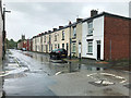
Image Listing (413 Images Found)
Images are licensed for reuse under creativecommons.org/licenses/by-sa/2.0
Image
Details
Distance
4

Clever Clogs
The Clever Clogs day nursery on Green Street is housed in the building which used to be "The Peel Monument" public house.
Image: © David Dixon
Taken: 22 Dec 2013
0.03 miles
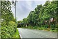
5

Pilkington Way (A665)
The town-centre bypass, constructed in the 1980s to relieve traffic congestion along Blackburn Street, the traditional route through the town.
Image: © David Dixon
Taken: 26 May 2020
0.04 miles

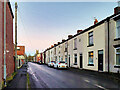
10

Factory on Wolsey Street
Factory at the corner of Wolsey Street and School Street.
Image: © David Dixon
Taken: 22 Feb 2014
0.05 miles