IMAGES TAKEN NEAR TO
Butt Hill Road, MANCHESTER, M25 9NJ
Introduction
This page details the photographs taken nearby to Butt Hill Road, M25 9NJ by members of the Geograph project.
The Geograph project started in 2005 with the aim of publishing, organising and preserving representative images for every square kilometre of Great Britain, Ireland and the Isle of Man.

There are currently over 7.5m images from over14,400 individuals and you can help contribute to the project by visiting https://www.geograph.org.uk
Image Map
Images are licensed for reuse under creativecommons.org/licenses/by-sa/2.0
Notes
- Clicking on the map will re-center to the selected point.
- The higher the marker number, the further away the image location is from the centre of the postcode.
Image Listing (24 Images Found)
Images are licensed for reuse under creativecommons.org/licenses/by-sa/2.0
Image
Details
Distance
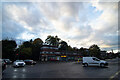
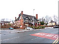
3
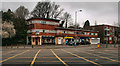
Hilton Park
Shops and houses at Hilton Park.
Image: © Peter McDermott
Taken: 16 Mar 2014
0.06 miles
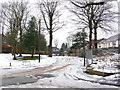
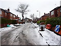
6
Junction Bury New Road and Scholes Lane
Image: © Ivor Josephson
Taken: 23 Oct 2022
0.08 miles
7
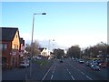
The A56 crosses the A6044 at Prestwich
Image: © Raymond Knapman
Taken: 26 Jan 2012
0.09 miles
9
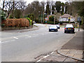
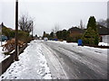
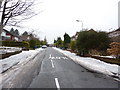
Hilton Lane
Looking along Hilton Lane (A6044) from Myrtle Grove towards Sedgley Park.
Image: © David Dixon
Taken: 27 Mar 2010
0.13 miles