IMAGES TAKEN NEAR TO
Egypt Lane, MANCHESTER, M25 2RU
Introduction
This page details the photographs taken nearby to Egypt Lane, M25 2RU by members of the Geograph project.
The Geograph project started in 2005 with the aim of publishing, organising and preserving representative images for every square kilometre of Great Britain, Ireland and the Isle of Man.

There are currently over 7.5m images from over14,400 individuals and you can help contribute to the project by visiting https://www.geograph.org.uk
Image Map
Images are licensed for reuse under creativecommons.org/licenses/by-sa/2.0
Notes
- Clicking on the map will re-center to the selected point.
- The higher the marker number, the further away the image location is from the centre of the postcode.
Image Listing (7 Images Found)
Images are licensed for reuse under creativecommons.org/licenses/by-sa/2.0
Image
Details
Distance
1
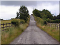
Egypt Lane
Approaching the bridge over the M62 at Simister.
Image: © David Dixon
Taken: 29 Jun 2010
0.06 miles


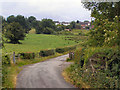
5

M62 Looking Towards Simister Island
Looking towards the M62/M60/M66 junction at Simister Island from the bridge at Egypt Lane.
Image: © David Dixon
Taken: 29 Jun 2010
0.16 miles
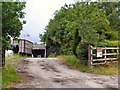
6
Egypt Lane
Close to Lower Droughts Farm, approaching Simister.
Image: © David Dixon
Taken: 29 Jun 2010
0.19 miles
7

M62
Looking Eastwards from the bridge at Egypt Lane.
Image: © David Dixon
Taken: 29 Jun 2010
0.23 miles