IMAGES TAKEN NEAR TO
Hastings Road, MANCHESTER, M25 1PF
Introduction
This page details the photographs taken nearby to Hastings Road, M25 1PF by members of the Geograph project.
The Geograph project started in 2005 with the aim of publishing, organising and preserving representative images for every square kilometre of Great Britain, Ireland and the Isle of Man.

There are currently over 7.5m images from over14,400 individuals and you can help contribute to the project by visiting https://www.geograph.org.uk
Image Map
Images are licensed for reuse under creativecommons.org/licenses/by-sa/2.0
Notes
- Clicking on the map will re-center to the selected point.
- The higher the marker number, the further away the image location is from the centre of the postcode.
Image Listing (68 Images Found)
Images are licensed for reuse under creativecommons.org/licenses/by-sa/2.0
Image
Details
Distance
1
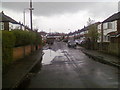
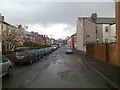
Noreen Avenue, Prestwich
Cul-de-sac off St Austell's Drive
Image: © Duncan Watts
Taken: 22 Apr 2012
0.09 miles
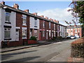
3
St Austell's Drive, Prestwich - 29-11-2010
Image: © Duncan Watts
Taken: 29 Nov 2010
0.13 miles
4
Orange Hill Road, Prestwich
Showing position of Postbox No. M25 616.
See Image] for postbox.
Image: © JThomas
Taken: 10 Sep 2018
0.13 miles
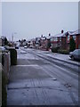
5
Hampden Road, Prestwich
Looking eastwards
Image: © Duncan Watts
Taken: 22 Apr 2012
0.13 miles
6
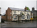
St Margaret's Tavern, Bury Old Road
Image: © Alexander P Kapp
Taken: 1 May 2009
0.13 miles
8
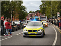
2012 Olympic Torch Relay, Prestwich
The 2012 Olympic Torch procession travels down Bury Old Road (A665).
Image: © David Dixon
Taken: 23 Jun 2012
0.14 miles
9
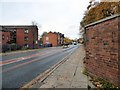
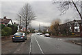
Bury Old Road
The A665 near the junction with Orange Hill Road.
Image: © Gerald England
Taken: 10 Nov 2018
0.15 miles
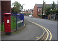
10
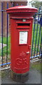
George V postbox on Bury Old Road, Prestwich
Postbox No. M25 616.
Image: © JThomas
Taken: 10 Sep 2018
0.15 miles