IMAGES TAKEN NEAR TO
Compton Way, MANCHESTER, M24 2BG
Introduction
This page details the photographs taken nearby to Compton Way, M24 2BG by members of the Geograph project.
The Geograph project started in 2005 with the aim of publishing, organising and preserving representative images for every square kilometre of Great Britain, Ireland and the Isle of Man.

There are currently over 7.5m images from over14,400 individuals and you can help contribute to the project by visiting https://www.geograph.org.uk
Image Map
Images are licensed for reuse under creativecommons.org/licenses/by-sa/2.0
Notes
- Clicking on the map will re-center to the selected point.
- The higher the marker number, the further away the image location is from the centre of the postcode.
Image Listing (15 Images Found)
Images are licensed for reuse under creativecommons.org/licenses/by-sa/2.0
Image
Details
Distance
1
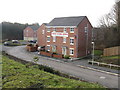
Show Home Open
New housing on the former Bradshaw Trading Estate, off Greengate.
Image: © Peter Whatley
Taken: 19 Jan 2011
0.17 miles
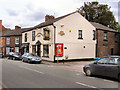
2
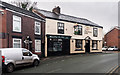
The Gardeners Arms
The Gardeners Arms public house near Chadderton.
Image: © Peter McDermott
Taken: 27 Dec 2014
0.18 miles
3
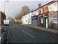
Middleton Junction - Grimshaw Lane, looking west
Image: © Peter Whatley
Taken: 19 Jan 2011
0.18 miles
4
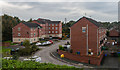
Waters Edge
Housing development on Waters Edge.
Image: © Peter McDermott
Taken: 17 Oct 2014
0.19 miles
5
The Gardeners Arms
Grimshaw Lane, Middleton.
Image: © David Dixon
Taken: 6 Jul 2010
0.20 miles
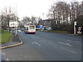
6
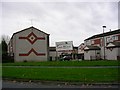
The Heath, Alkrington Garden Village
Image: © Keith Williamson
Taken: 11 Nov 2005
0.21 miles
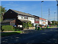
8
Lees Brewery offices
Viewed from across Grimshaw Lane.
Image: © Peter Whatley
Taken: 19 Jan 2011
0.23 miles
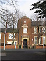
9
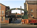
Greengate Brewery main entrance
Appropriately on Lees Street.
Image: © Peter Whatley
Taken: 19 Jan 2011
0.23 miles
10
Middleton Junction - northern end of Greengate
Image: © Peter Whatley
Taken: 19 Jan 2011
0.23 miles