IMAGES TAKEN NEAR TO
Evesham Road, MANCHESTER, M24 1PY
Introduction
This page details the photographs taken nearby to Evesham Road, M24 1PY by members of the Geograph project.
The Geograph project started in 2005 with the aim of publishing, organising and preserving representative images for every square kilometre of Great Britain, Ireland and the Isle of Man.

There are currently over 7.5m images from over14,400 individuals and you can help contribute to the project by visiting https://www.geograph.org.uk
Image Map
Images are licensed for reuse under creativecommons.org/licenses/by-sa/2.0
Notes
- Clicking on the map will re-center to the selected point.
- The higher the marker number, the further away the image location is from the centre of the postcode.
Image Listing (5 Images Found)
Images are licensed for reuse under creativecommons.org/licenses/by-sa/2.0
Image
Details
Distance
1
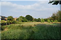
Grassland on the edge of Alkrington
A strip of open land between Alkrington and Blackley Golf Club.
Image: © Bill Boaden
Taken: 9 Jul 2013
0.09 miles
2
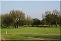
Blackley Golf Club
It managed to remain unscathed by the building of the nearby M60 motorway.
Image: © Bill Boaden
Taken: 9 Jul 2013
0.11 miles
3
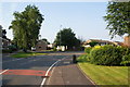
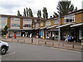
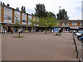
Evesham Road, Alkrington
This part of Alkrington extended the original area of housing.
Image: © Bill Boaden
Taken: 9 Jul 2013
0.12 miles