IMAGES TAKEN NEAR TO
Colshaw Road, MANCHESTER, M23 2QQ
Introduction
This page details the photographs taken nearby to Colshaw Road, M23 2QQ by members of the Geograph project.
The Geograph project started in 2005 with the aim of publishing, organising and preserving representative images for every square kilometre of Great Britain, Ireland and the Isle of Man.

There are currently over 7.5m images from over14,400 individuals and you can help contribute to the project by visiting https://www.geograph.org.uk
Image Map
Images are licensed for reuse under creativecommons.org/licenses/by-sa/2.0
Notes
- Clicking on the map will re-center to the selected point.
- The higher the marker number, the further away the image location is from the centre of the postcode.
Image Listing (5 Images Found)
Images are licensed for reuse under creativecommons.org/licenses/by-sa/2.0
Image
Details
Distance
4
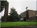
St. Paul's R.C. High School
These buildings, the road by which they stand, and indeed the M56 behind them at Newall Green, Wythenshawe, were not in evidence on the 1940's survey map.
Image: © Roger May
Taken: 4 Oct 2005
0.22 miles
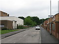
5
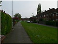
Belford Walk, leading to Baguley Hall Primary School
Image: © Eirian Evans
Taken: 23 Apr 2009
0.23 miles