IMAGES TAKEN NEAR TO
Calve Croft Road, MANCHESTER, M22 5FU
Introduction
This page details the photographs taken nearby to Calve Croft Road, M22 5FU by members of the Geograph project.
The Geograph project started in 2005 with the aim of publishing, organising and preserving representative images for every square kilometre of Great Britain, Ireland and the Isle of Man.

There are currently over 7.5m images from over14,400 individuals and you can help contribute to the project by visiting https://www.geograph.org.uk
Image Map
Images are licensed for reuse under creativecommons.org/licenses/by-sa/2.0
Notes
- Clicking on the map will re-center to the selected point.
- The higher the marker number, the further away the image location is from the centre of the postcode.
Image Listing (16 Images Found)
Images are licensed for reuse under creativecommons.org/licenses/by-sa/2.0
Image
Details
Distance
1
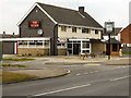
The Tudor
Public house on Peel Hall Lane.
Image: © David Dixon
Taken: 16 Sep 2011
0.07 miles
2
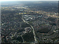
Concord Business Park from the air
Just after take-off from Manchester Airport to the east.
Image: © Thomas Nugent
Taken: 2 Apr 2013
0.13 miles
3
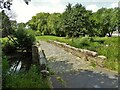
Moat Bridge
View towards the site of Peel Hall which was a moated site. It is now the centre of Peel Hall Park.
Image: © Kevin Waterhouse
Taken: 25 Jun 2023
0.15 miles
4
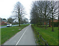
Cycle path along Simonsway, Wythenshawe
Image: © Anthony O'Neil
Taken: 29 Mar 2011
0.20 miles
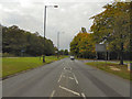
5
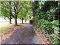
Footpath alongside Simonsway
The footpath is set back from the roadside.
Image: © Gerald England
Taken: 5 Sep 2016
0.21 miles
6
Front path to Concord Business Park, Wythenshawe
Image: © Anthony O'Neil
Taken: 29 Mar 2011
0.21 miles
7
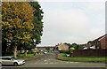
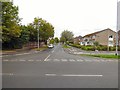
Portrush Road and Simonsway junction
In Wythenshawe, which was originally in Cheshire but became part of Manchester in 1931.
Image: © philandju
Taken: 19 Sep 2017
0.22 miles
9
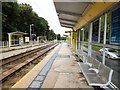
Peel Hall Tram Stop
On the line to Manchester Airport.
Image: © Gerald England
Taken: 5 Sep 2016
0.22 miles