IMAGES TAKEN NEAR TO
Tetbury Road, MANCHESTER, M22 1GW
Introduction
This page details the photographs taken nearby to Tetbury Road, M22 1GW by members of the Geograph project.
The Geograph project started in 2005 with the aim of publishing, organising and preserving representative images for every square kilometre of Great Britain, Ireland and the Isle of Man.

There are currently over 7.5m images from over14,400 individuals and you can help contribute to the project by visiting https://www.geograph.org.uk
Image Map
Images are licensed for reuse under creativecommons.org/licenses/by-sa/2.0
Notes
- Clicking on the map will re-center to the selected point.
- The higher the marker number, the further away the image location is from the centre of the postcode.
Image Listing (22 Images Found)
Images are licensed for reuse under creativecommons.org/licenses/by-sa/2.0
Image
Details
Distance
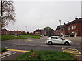
2
Apartments at the junction of Painswick Road and Portway
Image: © Eirian Evans
Taken: 23 Oct 2018
0.08 miles
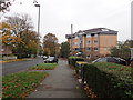
3
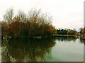
Painswick Road
These boarded-up houses enjoy fine views over the lake in Painswick Park Image
Image: © Thomas Nugent
Taken: 31 Jul 2007
0.11 miles
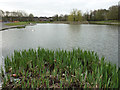
6
Waterbirds feeding in Painswick Park, Wythenshaw
Image: © Anthony O'Neil
Taken: 25 Oct 2010
0.13 miles
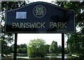
7
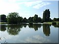
Painswick Park
A view of the lake. The edge of the swingpark is just visible on the right.
Image: © Thomas Nugent
Taken: 31 Jul 2007
0.13 miles
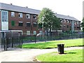
8
Painswick Park
Lake in Paisnwick Park
Image: © Richard Croft
Taken: 23 Apr 2013
0.16 miles
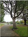
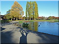
9
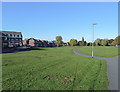
Open space with footpath/cycleway - Wythenshaw - Manchester
One of a number of large, welcome grassy areas in Wythenshaw housing estate - a model of urban relocation in the 1950s and one which was once visited by the Russian leader, Nikita Khruschev!
Image: © Anthony O'Neil
Taken: 25 Oct 2010
0.17 miles
10
Painswick Park
Viewed from the Bailey Lane entrance to the park.
Manchester City Council's web site describes it as follows...
The site was originally farming land until the late 1950s. Its function then changed to a landfill site which in time was grassed over to form a mound.
In 1962 the site was handed over to the council and an artificial lake constructed to serve as a holding pool for surplus flood water from the nearby Baguley Brook during severe rain storms.
Poundswick Park was officially opened 1968.
The lake is stocked with a variety of fish and used by local anglers.
Image: © Thomas Nugent
Taken: 31 Jul 2007
0.18 miles