IMAGES TAKEN NEAR TO
Parsonage Road, MANCHESTER, M20 4PW

Introduction

This page details the photographs taken nearby to Parsonage Road, M20 4PW by members of the Geograph project.

The Geograph project started in 2005 with the aim of publishing, organising and preserving representative images for every square kilometre of Great Britain, Ireland and the Isle of Man.

There are currently over 7.5m images from over14,400 individuals and you can help contribute to the project by visiting https://www.geograph.org.uk

Image Map


Images are licensed for reuse under creativecommons.org/licenses/by-sa/2.0
Notes
  • Clicking on the map will re-center to the selected point.
  • The higher the marker number, the further away the image location is from the centre of the postcode.

Image Listing (130 Images Found)

Images are licensed for reuse under creativecommons.org/licenses/by-sa/2.0
  • ...
Image
Details
Distance
1
Withington - Swinbourne Grove
Image: © Peter Whatley Taken: 31 Mar 2009
0.02 miles
2
Pencils on Parsonage Road
I assume they are there to remind people that they are approaching St Paul's C of E Primary School. They appeared around 2016/17.
Image: © Gerald England Taken: 10 Jul 2021
0.04 miles
3
Withington - Heaton Road
Image: © Peter Whatley Taken: 31 Mar 2009
0.04 miles
4
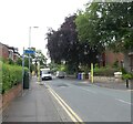
Withington - Parsonage Road
Image: © Peter Whatley Taken: 31 Mar 2009
0.05 miles
5
Scout Hut on Heaton Road
The hut is home to 1st Withington Scouts https://www.withingtonscouts.org.uk/
Image: © Gerald England Taken: 3 Jul 2019
0.05 miles
6
From God To Mammon
A church sits alongside NatWest bank, nationalised as part of the failed RBS Group early in 2009.
Image: © Peter Whatley Taken: 31 Mar 2009
0.08 miles
7
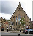
Withington Methodist Church
According to an archived church website http://web.archive.org/web/20170507093852/http://www.withingtonmethodistchurch.com/history.html "Withington Methodist Church owes its origin to the vision of two twelve-year-old girls, Hannah Hesketh and Hannah Langford, who in the 1790s heard the gospel in neighbouring Burnage and asked that a bible class be run for them in Withington. From this class held originally in farmhouse kitchens a worshipping community developed who, in 1832, erected a small chapel in old Moat and subsequently built the present building in 1865. After a survey of the premises in 1992, the church members decided that rather than spend over £100,000 on repairs to the ageing building they would take the bold step of redeveloping the church. The redevelopment scheme involved the demolition of ancillary buildings at the rear of the church and the erection of a new floor within the main worship area, to create the space for exciting new projects. Partners were found to share in the scheme: The South Manchester Universities Hospital Trust, Citizens Advice Bureau, and ASSIST neighbourhood care group together offer a wide range of community services under one roof and the building enables church members to worship God in more contemporary surroundings and also practise a caring Christian ministry to the people of Withington."
Image: © Gerald England Taken: 15 Sep 2017
0.08 miles
8
Withington Walls
Created in 2019 as part of the Withington Walls project these murals on Southside were the work of Hammo and Jay Sharples.
Image: © Gerald England Taken: 18 Dec 2021
0.08 miles
9
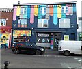
Al Jameirah
The restaurant at 461 Wilmslow Road opened in 2017. Between 2008 and 2015 it had been a cafe-bar called "Four-Six-One". The property had originally been a branch of Barclays Bank.
Image: © Gerald England Taken: 15 Sep 2017
0.09 miles
10
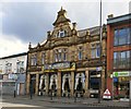
Former NatWest bank, Wilmslow Road
The light stone panel to the right of the entrance once held an ATM
Image: © David Smith Taken: 24 Oct 2019
0.09 miles
  • ...