IMAGES TAKEN NEAR TO
Davenport Avenue, MANCHESTER, M20 3FS
Introduction
This page details the photographs taken nearby to Davenport Avenue, M20 3FS by members of the Geograph project.
The Geograph project started in 2005 with the aim of publishing, organising and preserving representative images for every square kilometre of Great Britain, Ireland and the Isle of Man.

There are currently over 7.5m images from over14,400 individuals and you can help contribute to the project by visiting https://www.geograph.org.uk
Image Map
Images are licensed for reuse under creativecommons.org/licenses/by-sa/2.0
Notes
- Clicking on the map will re-center to the selected point.
- The higher the marker number, the further away the image location is from the centre of the postcode.
Image Listing (106 Images Found)
Images are licensed for reuse under creativecommons.org/licenses/by-sa/2.0
Image
Details
Distance
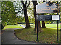
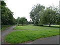
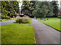
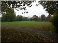
2
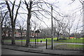
Old Moat Park
This open space is a relic from the time before the surrounding housing development began, with roots from the former manor.
Image: © Bill Boaden
Taken: 27 Dec 2012
0.05 miles
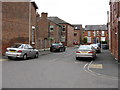
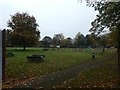
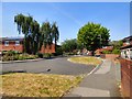
6
Hill Street, to the west of Old Moat Park
The park is to the right, behind the railings
Image: © David Smith
Taken: 24 Oct 2019
0.09 miles
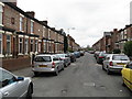
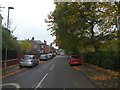
8
Strathblane Close
Originally Barbican Street.
Image: © Gerald England
Taken: 26 Jun 2018
0.11 miles