IMAGES TAKEN NEAR TO
Lakenheath Close, MANCHESTER, M20 2WP

Introduction

This page details the photographs taken nearby to Lakenheath Close, M20 2WP by members of the Geograph project.

The Geograph project started in 2005 with the aim of publishing, organising and preserving representative images for every square kilometre of Great Britain, Ireland and the Isle of Man.

There are currently over 7.5m images from over14,400 individuals and you can help contribute to the project by visiting https://www.geograph.org.uk

Image Map


Images are licensed for reuse under creativecommons.org/licenses/by-sa/2.0
Notes
  • Clicking on the map will re-center to the selected point.
  • The higher the marker number, the further away the image location is from the centre of the postcode.

Image Listing (131 Images Found)

Images are licensed for reuse under creativecommons.org/licenses/by-sa/2.0
  • ...
Image
Details
Distance
1
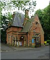
The Lodge, The Towers, Didsbury
The Towers was the home of Daniel Adamson, the Victorian engineer who was a leading promoter and backer of the campaign to build the Manchester Ship Canal. The blue plaque commemorates the inaugral meeting of that campaign, held here on 27th June 1882. ( See also Image ) For an account of the life of Adamson's sister, Elizabeth, and an account of Adamson's reception by the people of Didsbury following the passing of the Ship Canal Act see http://www.g4fas.net/fmmm.htm (courtesy of Geoff Royle, http://www.geograph.org.uk/profile/27109 )
Image: © Keith Williamson Taken: 14 Dec 2005
0.06 miles
2
Lodge to Didsbury Lodge, Wilmslow Road
Former lodge to Didsbury Lodge, built in the mid 19th century. Both the building and the gate and walls are Grade II listed.
Image: © Eirian Evans Taken: 10 May 2015
0.08 miles
3
Lodge on Wilmslow Road
Image: © JThomas Taken: 30 May 2024
0.08 miles
4
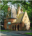
Lodge, Wilmslow Road
The tremendously pointy prelude to Didsbury Towers by Thomas Worthington, c1870. Grade II listed. Its 884 square feet were available to rent at the time.
Image: © Stephen Richards Taken: 27 May 2016
0.09 miles
5
Cricket ground, East Didsbury
Image: © JThomas Taken: 30 May 2024
0.12 miles
6
East Didsbury Cricket Club
Image: © Gerald England Taken: 26 Apr 2021
0.12 miles
7
Didsbury Cricket Club
Image: © Bill Boaden Taken: 13 Apr 2012
0.13 miles
8
Shops on Wilmslow Road
A group of three (end of a row of four) shops between Parrs Wood Road and Parrs Wood Avenue. On the left is the Good Fortune Chinese restaurant. On the right below the Didsbury Holistic Centre is a computer shop. When the google-car took images for Streetview (2008/09) it appears the end shop was vacant and the computer shop was in the middle. Now it has moved next door the middle premises are now the offices of Didsbury Family Law solicitors.
Image: © Gerald England Taken: 21 Jul 2012
0.15 miles
9
East Didsbury
The junction of Wilmslow Road with Parrs Wood Road; the railway bridge is ahead.
Image: © David Dixon Taken: 27 Sep 2011
0.16 miles
10
Didsbury Cricket Club
Looking across Didsbury CC's Wilmslow Road ground towards Parrs Wood Road and Kingsway. The first XI play in the ECB Cheshire Premier League. The club also run four other teams in the Cheshire County Cricket League and a women's team in the Cheshire Women's Cricket League. The ground is looking a little worn probably due to winter lacrosse use.
Image: © BatAndBall Taken: 25 Mar 2013
0.16 miles
  • ...