IMAGES TAKEN NEAR TO
Broom Lane, MANCHESTER, M19 3LY
Introduction
This page details the photographs taken nearby to Broom Lane, M19 3LY by members of the Geograph project.
The Geograph project started in 2005 with the aim of publishing, organising and preserving representative images for every square kilometre of Great Britain, Ireland and the Isle of Man.

There are currently over 7.5m images from over14,400 individuals and you can help contribute to the project by visiting https://www.geograph.org.uk
Image Map
Images are licensed for reuse under creativecommons.org/licenses/by-sa/2.0
Notes
- Clicking on the map will re-center to the selected point.
- The higher the marker number, the further away the image location is from the centre of the postcode.
Image Listing (33 Images Found)
Images are licensed for reuse under creativecommons.org/licenses/by-sa/2.0
Image
Details
Distance
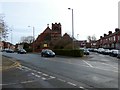
1
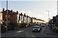
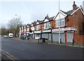
Broom Lane
The houses are lit by late winter sun.
Image: © Bill Boaden
Taken: 10 Jan 2020
0.05 miles
2
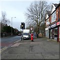
Barlow Road
The GR postbox (M19 566D) Image is outside what used to be a Post Office until 2008. That shop in a row of eight Image is now a barbers.
Image: © Gerald England
Taken: 7 Mar 2020
0.10 miles
3
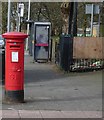
GR postbox (M19 566D)
On Barlow Road Image outside what used to be a Post Office until 2008. Behind the phone box and bus stop is an entrance to Greenbank playing fields.
Image: © Gerald England
Taken: 7 Mar 2020
0.10 miles
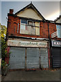
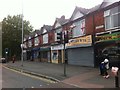
5
Shops on Barlow Road
A parade of eight shops.
Image: © Gerald England
Taken: 7 Mar 2020
0.10 miles
7
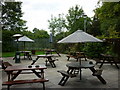
The Blue Bell, Levenshulme, Manchester
The beer garden at this Sam Smith's public house.
Image: © Ian S
Taken: 29 Jul 2011
0.12 miles
8
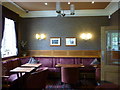
The Blue Bell, Levenshulme, Manchester
One of the rooms in this Sam Smith's public house.
Image: © Ian S
Taken: 29 Jul 2011
0.12 miles
9
St Mark's, Levenshulme
St Mark’s Church opened its doors in 1908 to serve the growing community of the Tallyrand or Back Levenshulme area, as the eastern part of Levenshulme was known locally at the time. Prior to this, from 1883, meetings had been held in the Old Mission Room. The number of worshippers grew too large for the space and in 1894 they moved into the New Church School Building, where they remained until the church itself was built. It is now part of the combined Parish of St Peter and St Mark. https://stpeterandstmarklevenshulme.org.uk/about-2/
Image: © Gerald England
Taken: 7 Mar 2020
0.12 miles
10
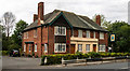
Blue Bell Inn
The Blue Bell Inn on Barlow Road.
Image: © Peter McDermott
Taken: 2 Jul 2019
0.12 miles