1
Public allotments, Levenshulme
This view looking from ' Tallyrand ' shows part of a huge acreage of public allotments. The block of flats centre left is Cundiff Court, a social housing development. The famous architect Norman Foster designer of many impressive buildings worldwide e.g. London's Gherkin, grew up in streets nearby, in fact his birthplace in Reddish is not far behind the camera position.
Image: © Geoff Royle
Taken: 4 Mar 2010
0.05 miles
2
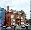
Polygon Hotel
The Polygon Hotel at the corner of Printworks Lane and Barlow Road in Levenshulme.
Image: © David Dixon
Taken: 7 Nov 2012
0.11 miles
3
Polygon Hotel - Levenshulme
Image: © Anthony Parkes
Taken: 28 Jun 2011
0.11 miles
4
Levenshulme, Barlow Road
Image: © David Dixon
Taken: 7 Nov 2012
0.11 miles
5
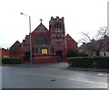
St Mark's, Levenshulme
St Mark’s Church opened its doors in 1908 to serve the growing community of the Tallyrand or Back Levenshulme area, as the eastern part of Levenshulme was known locally at the time. Prior to this, from 1883, meetings had been held in the Old Mission Room. The number of worshippers grew too large for the space and in 1894 they moved into the New Church School Building, where they remained until the church itself was built. It is now part of the combined Parish of St Peter and St Mark. https://stpeterandstmarklevenshulme.org.uk/about-2/
Image: © Gerald England
Taken: 7 Mar 2020
0.13 miles
6
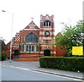
St Mark's Church, Levenshulme
St Mark's Church is on the corner of Barlow Road and Mount Road, Levenshulme.
Image: © David Dixon
Taken: 7 Nov 2012
0.13 miles
7
St Mark's Church - Levenshulme
Image: © Anthony Parkes
Taken: 28 Jun 2011
0.13 miles
8
St Mark's, Levenshulme
St Mark’s Church opened its doors in 1908 to serve the growing community of the Tallyrand or Back Levenshulme area, as the eastern part of Levenshulme was known locally at the time. Prior to this, from 1883, meetings had been held in the Old Mission Room. The number of worshippers grew too large for the space and in 1894 they moved into the New Church School Building, where they remained until the church itself was built. It is now part of the combined Parish of St Peter and St Mark. https://stpeterandstmarklevenshulme.org.uk/about-2/
Image: © Gerald England
Taken: 7 Mar 2020
0.13 miles
9
Corner shop on Barlow Road
On the corner of Barlow Road and Peter Moss Way. The Polygon Hotel, now closed, as at the far end of the road.
Image: © Bill Boaden
Taken: 10 Jan 2020
0.13 miles
10
National Cycle Route 6, Fallowfield Loop Line
National Cycle Route 6 enters Manchester from Reddish via the traffic-free former Fallowfield Loop Line and then on residential streets through Whalley Range into the city centre.
Image: © David Dixon
Taken: 7 Nov 2012
0.14 miles


