IMAGES TAKEN NEAR TO
York Street, MANCHESTER, M1 7DE

Introduction

This page details the photographs taken nearby to York Street, M1 7DE by members of the Geograph project.

The Geograph project started in 2005 with the aim of publishing, organising and preserving representative images for every square kilometre of Great Britain, Ireland and the Isle of Man.

There are currently over 7.5m images from over14,400 individuals and you can help contribute to the project by visiting https://www.geograph.org.uk

Image Map


Images are licensed for reuse under creativecommons.org/licenses/by-sa/2.0
Notes
  • Clicking on the map will re-center to the selected point.
  • The higher the marker number, the further away the image location is from the centre of the postcode.

Image Listing (945 Images Found)

Images are licensed for reuse under creativecommons.org/licenses/by-sa/2.0
  • ...
Image
Details
Distance
1
Manchester
Looking across the old BBC Oxford Road site.
Image: © Peter McDermott Taken: 1 Nov 2015
0.01 miles
2
Manchester: entrance to car park, Pritchard Street
The car park is bounded by the River Medlock, here meandering almost unseen along the southern edge of the city centre.
Image: © Christopher Hilton Taken: 25 Jul 2013
0.01 miles
3
Bracken House, Charles Street, Manchester
1960s/1970s office block, its brown and white layers reminiscent of an ice cream dessert. Ground floor currently occupied by Paintpots, a children's nursery.
Image: © Stephen Richards Taken: 23 Jul 2011
0.02 miles
4
Bracken House
View looking across the site of the old BBC Oxford Road studio site towards Bracken House on Charles Street.
Image: © Peter McDermott Taken: 17 May 2015
0.02 miles
5
Island car park
The River Medlock runs between the car parking area and the lime-streaked brick wall supporting the ground beneath the buildings beyond.
Image: © David Long Taken: 25 Jun 2009
0.02 miles
6
Manchester: the Lass o' Gowrie pub, Charles Street
Taken from Pritchard Street which runs up the side of the pub.
Image: © Christopher Hilton Taken: 25 Jul 2013
0.02 miles
7
Manchester: River Medlock from Oxford Road
Image: © Christopher Hilton Taken: 25 Jul 2013
0.03 miles
8
Interior of the Palace Hotel bar
The original tiled walls and columns, as well as the wooden parquet flooring can still be seen in this view of the ground-floor bar of the hotel.
Image: © Steve Courtney Taken: 10 Apr 2009
0.03 miles
9
38 Charles Street, Manchester
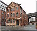
Former warehouse with a nice short brick and terracotta front to Charles Street and a long utilitarian brick one to Pritchard Street. Dated 1912 in the pediment (Image]). The variation in brick colour suggests it may have since been partly rebuilt. Now occupied by auctioneers Capes Dunn & Co. Behind is part of the railway viaduct between Piccadilly and Oxford Road stations.
Image: © Stephen Richards Taken: 16 May 2012
0.03 miles
10
Cape Dunns
Fine Art auctioneers and valuers established in 1826. http://www.capesdunn.com/ Their premises on the corner of Charles Street and Pritchard Street date from 1912. The archway on the right carries the Piccadilly to Oxford Road railway line.
Image: © Gerald England Taken: 2 Jul 2012
0.03 miles
  • ...