IMAGES TAKEN NEAR TO
Kestrel Road, MANCHESTER, M17 1SF
Introduction
This page details the photographs taken nearby to Kestrel Road, M17 1SF by members of the Geograph project.
The Geograph project started in 2005 with the aim of publishing, organising and preserving representative images for every square kilometre of Great Britain, Ireland and the Isle of Man.

There are currently over 7.5m images from over14,400 individuals and you can help contribute to the project by visiting https://www.geograph.org.uk
Image Map
Images are licensed for reuse under creativecommons.org/licenses/by-sa/2.0
Notes
- Clicking on the map will re-center to the selected point.
- The higher the marker number, the further away the image location is from the centre of the postcode.
Image Listing (16 Images Found)
Images are licensed for reuse under creativecommons.org/licenses/by-sa/2.0
Image
Details
Distance
2
Guinness Trading Estate, Trafford Park
Off Guinness Road.
Image: © Bill Boaden
Taken: 6 Apr 2015
0.10 miles
3
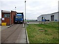
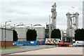
Viridor IVC Plant, Trafford Park
This is a photo of a lorry full of composted that has been produce by Viridor's In Vessel Composting Plant on Nash Road, Trafford Park. This site treats co-mingled catering and green wasted that is gathered in brown bin collections. This waste undergoes composting in the silver building on the right for 7-8 weeks. Then it is transported off site for use as compost.
Image: © Rude Health
Taken: 24 Jan 2013
0.10 miles
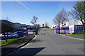
4
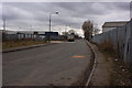
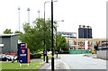
Ashburton Road, Trafford Park
One of the main distributor roads on the estate.
Image: © Alan Murray-Rust
Taken: 12 May 2015
0.12 miles
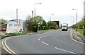
5
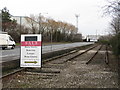
Ashburton Road West, Trafford Park
The railway sidings have been disused since the 1960s and are tarmacked over in a number of places.
Image: © Peter Whatley
Taken: 22 Jan 2009
0.15 miles
7
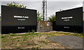
Harp Trading Estate, Trafford Park
The silos behind belong to the Cargill plant.
Image: © Bill Boaden
Taken: 6 Apr 2015
0.17 miles
9
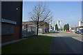
Harp Road, Trafford Park
Industrial redevelopment on the former Guinness site.
Image: © Alan Murray-Rust
Taken: 12 May 2015
0.17 miles
10
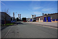
Harp Trading Estate
The name and symbol, but not the colours, refer to the fact that the estate has been developed on the former Guinness plant site.
Image: © Alan Murray-Rust
Taken: 12 May 2015
0.18 miles