IMAGES TAKEN NEAR TO
Trafford Park Road, MANCHESTER, M17 1NX
Introduction
This page details the photographs taken nearby to Trafford Park Road, M17 1NX by members of the Geograph project.
The Geograph project started in 2005 with the aim of publishing, organising and preserving representative images for every square kilometre of Great Britain, Ireland and the Isle of Man.

There are currently over 7.5m images from over14,400 individuals and you can help contribute to the project by visiting https://www.geograph.org.uk
Image Map
Images are licensed for reuse under creativecommons.org/licenses/by-sa/2.0
Notes
- Clicking on the map will re-center to the selected point.
- The higher the marker number, the further away the image location is from the centre of the postcode.
Image Listing (40 Images Found)
Images are licensed for reuse under creativecommons.org/licenses/by-sa/2.0
Image
Details
Distance
2

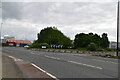
The end of Trafford Park Road
Looking down from the approach to Centenary Bridge.
Image: © Alan Murray-Rust
Taken: 12 May 2015
0.11 miles
3

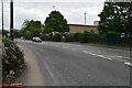
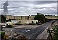
Derelict railway in Trafford Park
Rails have been removed except at former level crossings.
Image: © Alan Murray-Rust
Taken: 12 May 2015
0.11 miles
5
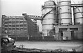
Hedley's Soapworks - Trafford Park c.1952
The former Trafford Park, Manchester factory of soap manufacturer Thomas Hedley Ltd whose company was based in Newcastle upon Tyne. As well as the plant at Trafford Park, another was at West Thurrock, near Grays, Essex. Founded in 1837, the company was known for its brand name Fairy soap, and the washing powder Oxydol. After the company was acquired by Proctor & Gamble in 1930, other brands were introduced that included the washing powders Daz and Tide. Considerable expansion of the 10 acre site occurred during the 1930s which entailed the acquisition of a further 5 acres. A pipe bridge was also constructed to bring oil from ships berthed on the north side of the Manchester Ship Canal. I suspect the signboard on the left gate pier is an old air raid shelter sign, its painted direction arrow indicator was fairly ubiquitous for civil shelters during the Second World War.
Since this photo was taken the factory has been demolished, and a whole new landscape of industrial buildings now occupies the site.
Image: © Ronald Searle
Taken: Unknown
0.11 miles
6
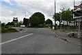
Tank with a hat
Probably to do with waste water collection.
Image: © Alan Murray-Rust
Taken: 12 May 2015
0.11 miles
7
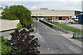
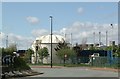
Essity
The Essity plant at Trafford Park.
Image: © Peter McDermott
Taken: 4 Jun 2020
0.11 miles