1
Withington Road Shops, Whalley Range
Image: © David Dixon
Taken: 13 Jul 2010
0.05 miles
2
Whalley Range Community Centre (Nello James Centre)
The disused and derelict Nello James Centre on Withington Road.
Image: © Peter McDermott
Taken: 17 Apr 2017
0.07 miles
3
Wellington Road, Whalley Range
This piece of grassed-over land behind the railings used to be occupied by some large houses. The land is part of St Bede's College.
See http://www.geograph.org.uk/photo/633140
for pictures of the houses
Image: © Tom Jolliffe
Taken: Unknown
0.16 miles
4
Houses, Wellington Road, Whalley Range
The house on the far left, No 5, was owned by St Bede's College, the main buildings of which are situated on the opposite side of Wellington Road. This house was used in the distant past for the preparatory class of pupils at the school - the "Lower Third". The next house, number 7 was owned by the Salford Diocese and was rented out. An author, H W Timperley who wrote "A Cotswold Book" lived at 7 Wellington Road in June 1929. L S Lowry contributed twelve drawings for this book and corresponded with H W Timperley at this address.
See http://discovery.nationalarchives.gov.uk/download/GB%200425%20u52
The other houses were privately owned. The land at the end of this side of the road was owned by the College, which later acquired all these properties which were then demolished. This road used to be unadopted, but was later tarmaced in the 1970's? by the local authority.
Also see
Image]
Image]
Image]
Image: © Tom Jolliffe
Taken: Unknown
0.17 miles
5
St Bede's College, Whalley Range, Manchester
This building, part of St Bede's College, is called the Henshaw building. This was constructed circa 1930s and housed Science laboratories.
Image: © Tom Jolliffe
Taken: 25 Dec 1969
0.17 miles
6
St Bede's College from Alexandra Park
This private school is situated on Alexandra Road South.
Image: © Marcus Hargis
Taken: 2 Dec 2006
0.17 miles
7
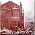
Wellington Road, Whalley Range
This semi detached Victorian house at 7 Wellington Road no longer exists, nor do any of the houses on this side of the road. St Bede's College - the "Beck" building is visible in the background - bought the houses and the ground is now part of the school. Snow in Whalley Range, Manchester, was a rare event.
Image: © Tom Jolliffe
Taken: 14 Dec 1969
0.17 miles
8
Withington Road
Image: © Anthony Parkes
Taken: 14 Mar 2012
0.17 miles
9
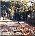
Wellington Road, Whalley Range, Autumn
Up to the 1970s, this road in Whalley Range was unadopted, so had potholes and dirt/gravel pavements, etc. In the Autumn, none of this mattered when the leaves were falling from the lime trees and the road took on a park-like appearance. Alexandra Park, a Victorian creation, lies at the end of the road. Also see
Image]
Image]
Image: © Tom Jolliffe
Taken: Unknown
0.17 miles
10
The Beck Building, St Bede's College, Wellington Road, Whalley Range
The St Bede's College Beck building was constructed in around 1958 and cost £100,000. As well as classrooms, it provided a new refectory.
Image: © Tom Jolliffe
Taken: Unknown
0.17 miles


