IMAGES TAKEN NEAR TO
Throstles Green, MANCHESTER, M16 0SN

Introduction

This page details the photographs taken nearby to Throstles Green, M16 0SN by members of the Geograph project.

The Geograph project started in 2005 with the aim of publishing, organising and preserving representative images for every square kilometre of Great Britain, Ireland and the Isle of Man.

There are currently over 7.5m images from over14,400 individuals and you can help contribute to the project by visiting https://www.geograph.org.uk

Image Map


Images are licensed for reuse under creativecommons.org/licenses/by-sa/2.0
Notes
  • Clicking on the map will re-center to the selected point.
  • The higher the marker number, the further away the image location is from the centre of the postcode.

Image Listing (279 Images Found)

Images are licensed for reuse under creativecommons.org/licenses/by-sa/2.0
  • ...
Image
Details
Distance
1
Harry Ramsden's, Chester Road, Old Trafford
Image: © michael ely Taken: 30 Apr 2008
0.03 miles
2
Railway, Old Trafford
The railway approaching Image] (which is just after the bridge). The corner of Image] can be seen above the trees on the right hand side of the picture.
Image: © David Dixon Taken: 5 May 2011
0.04 miles
3
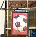
Sign of the Trafford
Sign for the Trafford Image
Image: © Gerald England Taken: 21 Aug 2017
0.07 miles
4
Roadworks at White City
Chester Road is affected by roadworks. In the background and looking somewhat incongruous is the Grade II listed https://historicengland.org.uk/listing/the-list/list-entry/1067874 Entrance portal and lodges to former White City greyhound track built in 1828 originally as the entrance to the Botanic Gardens. In 1907 the gardens were transformed into an amusement park which lasted until 1928. In 1930 the site became a greyhound track and it was also used as a speedway track. In 1953 an athletics track was created, In the 1970s it was used for stock car racing. The stadium closed in 1982 and was demolished to make way for the retail park that now occupies the site. http://manchesterhistory.net/manchester/gone/whitecity.html
Image: © Gerald England Taken: 21 Aug 2017
0.07 miles
5
Manchester : Trafford - Old Trafford
Looking beyond the trees towards the home of Man Utd.
Image: © Lewis Clarke Taken: 29 Oct 2013
0.08 miles
6
Leisuretime at White City
A Leisuretime coach is parked outside the Grade II listed https://historicengland.org.uk/listing/the-list/list-entry/1067874 Entrance portal and lodges to the former White City greyhound track built in 1828 originally as the entrance to the Botanic Gardens. In 1907 the gardens were transformed into an amusement park which lasted until 1928. In 1930 the site became a greyhound track and it was also used as a speedway track. In 1953 an athletics track was created, In the 1970s it was used for stock car racing. The stadium closed in 1982 and was demolished to make way for the retail park that now occupies the site. http://manchesterhistory.net/manchester/gone/whitecity.html
Image: © Gerald England Taken: 26 Aug 2017
0.08 miles
7
Railway lines into Trafford
From Trafford Road looking towards Old Trafford.
Image: © Gerald England Taken: 21 Aug 2017
0.08 miles
8
Chester Road, Old Trafford
The A56 outside the Trafford pub on the left. At the traffic lights the road on the right leads to the Old Trafford Stadium, home of Manchester United.
Image: © Gerald England Taken: 21 Aug 2017
0.08 miles
9
Built as the entrance to the White City Botanical Gardens, Chester Road, Stretford
Image: © Alexander P Kapp Taken: 14 Jun 2012
0.10 miles
10
Charlton House, Chester Road, Stretford
One of a cluster of substantial post-war office blocks in the Old Trafford area, perhaps part of a drive to attract business in the face of ailing industry. There is a local station, and the nearby A56 runs, in one direction, to what was the Stretford by-pass or M62 when it opened in 1960 (now the M60), and, in the other direction, to central Manchester. This one has a chunky stair tower and a slab resting on pilotis. In the distance on the left is another: Image
Image: © Stephen Richards Taken: 25 Jul 2011
0.10 miles
  • ...