IMAGES TAKEN NEAR TO
Ridley Walk, MANCHESTER, M15 6NJ
Introduction
This page details the photographs taken nearby to Ridley Walk, M15 6NJ by members of the Geograph project.
The Geograph project started in 2005 with the aim of publishing, organising and preserving representative images for every square kilometre of Great Britain, Ireland and the Isle of Man.

There are currently over 7.5m images from over14,400 individuals and you can help contribute to the project by visiting https://www.geograph.org.uk
Image Map
Images are licensed for reuse under creativecommons.org/licenses/by-sa/2.0
Notes
- Clicking on the map will re-center to the selected point.
- The higher the marker number, the further away the image location is from the centre of the postcode.
Image Listing (41 Images Found)
Images are licensed for reuse under creativecommons.org/licenses/by-sa/2.0
Image
Details
Distance
1
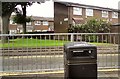
Tarnbrook Walk
Off Greenheys Lane, Moss Side.
Image: © Gerald England
Taken: 21 Jul 2012
0.06 miles
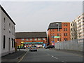
2
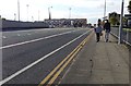
End of Greenheys Lane, Hulme
The road technically becomes Greenheys Lane West beyond the junction with Princess Road (A5103).
Image: © Bradley Michael
Taken: 13 Oct 2015
0.07 miles
3
Junction of Greenheys Lane with the A5103
Image: © Rod Allday
Taken: 12 Apr 2014
0.10 miles
5
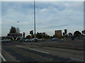
The junction of Greenhey Lane and Princess Road
Image: © Alexander P Kapp
Taken: 24 Oct 2011
0.11 miles
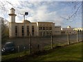
6
Darul Aman mosque on Greenheys Lane, Hulme
The mosque was built to serve the revisionist Islam movement Ahmadiyya and was funded by the community.
Image: © Rod Allday
Taken: 12 Apr 2014
0.13 miles
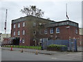
8
Manchester Mosque, Greenheys Lane
Image: © Christopher Hilton
Taken: 5 Mar 2019
0.13 miles
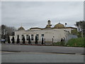
9
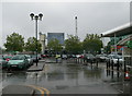
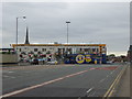
Hulme High Street Asda Car Park
Looking east - the Royal Brewery, owned by Heineken, is beyond the trees on the opposite side of Princess Road.
Image: © Eirian Evans
Taken: 8 Aug 2011
0.14 miles
10
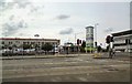
Hulme High Street
Corner of Princess Street and Greenheys Lane West. The regeneration of Moss Side including a large Asda supermarket and other shops.
Image: © Gerald England
Taken: 21 Jul 2012
0.15 miles