IMAGES TAKEN NEAR TO
Coleman Street, M15 4GD

Introduction

This page details the photographs taken nearby to Coleman Street, M15 4GD by members of the Geograph project.

The Geograph project started in 2005 with the aim of publishing, organising and preserving representative images for every square kilometre of Great Britain, Ireland and the Isle of Man.

There are currently over 7.5m images from over14,400 individuals and you can help contribute to the project by visiting https://www.geograph.org.uk

Image Map


Images are licensed for reuse under creativecommons.org/licenses/by-sa/2.0
Notes
  • Clicking on the map will re-center to the selected point.
  • The higher the marker number, the further away the image location is from the centre of the postcode.

Image Listing (1256 Images Found)

Images are licensed for reuse under creativecommons.org/licenses/by-sa/2.0
  • ...
Image
Details
Distance
1
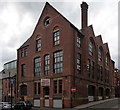
Former school, Little Peter Street, Manchester
Very nice, big gables, big arched windows and a big chimneystack. Formerly St. Peter's Schools, dated 1876, but now offices. A blue plaque records that it once housed the Boardwalk, "Madchester venue nightclub and rehearsal rooms 1984-99".
Image: © Stephen Richards Taken: 17 May 2012
0.01 miles
2
8 Hewitt Street, Manchester
One of the more substantial of the mostly minor Victorian warehouses in the surrounding streets. Now offices.
Image: © Stephen Richards Taken: 17 May 2012
0.01 miles
3
Deansgate Railway Station
The bridge which can be seen to the lower right hand side of the photograph is the footbridge linking the railway station to the Deansgate-Castlefield tram stop.
Image: © David Dixon Taken: 3 Jul 2014
0.01 miles
4
Deansgate Station
Image: © N Chadwick Taken: 28 Aug 2014
0.02 miles
5
Northern Rail Class 150, 150214, Deansgate railway station
At the platform with a service to Manchester Airport.
Image: © El Pollock Taken: 18 Jun 2015
0.02 miles
6
Bugle Street
Formerly an area of small industries, now largely redeveloped.
Image: © Alan Murray-Rust Taken: 14 Aug 2009
0.02 miles
7
Deansgate station
Image: © Peter Whatley Taken: 21 Jul 1991
0.02 miles
8
Gaythorn Tunnel
Plaque on Century Street Image commemorating the reconstruction of the tunnel in 1902. Originally the Rochdale Canal terminated at Dale Street basin. The Duke of Bridgewater was reluctant to allow it to join the Bridgewater Canal. Pressure from other canal builders finally changed his mind and the last section linking the two was built. The Duke's Lock is number 92 and lowers boats down to the Bridgewater Canal. Originally the section of canal between Lock 91 at the end of Whitworth Street West and lock 92 ran through a shallow tunnel. In later years much of this was opened up except for the short Gaythorn Tunnel that carries it below Deansgate.
Image: © Gerald England Taken: 1 Sep 2009
0.02 miles
9
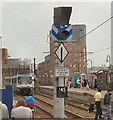
Change to Street Running Mode
At G-Mex, Metrolink trams change to "Street Running Mode".
Image: © Gerald England Taken: 27 Jun 2009
0.02 miles
10
Exhibition Footbridge
The Exhibition Footbridge Image crossing Whitworth Street from G-Mex tram station to Deansgate Railway Station.
Image: © Gerald England Taken: 1 Sep 2009
0.02 miles
  • ...