IMAGES TAKEN NEAR TO
Wellington Road, MANCHESTER, M14 6BN
Introduction
This page details the photographs taken nearby to Wellington Road, M14 6BN by members of the Geograph project.
The Geograph project started in 2005 with the aim of publishing, organising and preserving representative images for every square kilometre of Great Britain, Ireland and the Isle of Man.

There are currently over 7.5m images from over14,400 individuals and you can help contribute to the project by visiting https://www.geograph.org.uk
Image Map
Images are licensed for reuse under creativecommons.org/licenses/by-sa/2.0
Notes
- Clicking on the map will re-center to the selected point.
- The higher the marker number, the further away the image location is from the centre of the postcode.
Image Listing (33 Images Found)
Images are licensed for reuse under creativecommons.org/licenses/by-sa/2.0
Image
Details
Distance
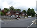
1
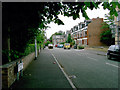
Latchmere Road, Fallowfield
Taken from the Wilmslow Road end.
Image: © Slbs
Taken: Unknown
0.08 miles
2
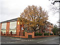
Withington Girls? School
Withington Girls’ School was founded in 1890 by a group of eminent Manchester families who wanted the same educational opportunities for their daughters as were already available for their sons.
Image: © Sue Adair
Taken: 22 Nov 2009
0.09 miles
3
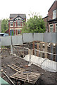
Leigh Brook Culvert
Leigh Brook, one of Manchester's 'lost rivers' now runs in a culvert under parts of Fallowfield and Withington. It used to form the boundary between Manchester and Withington.
Photo taken during recent repairs to the culvert.
Image: © Karel Hladky
Taken: 25 May 2004
0.10 miles
6
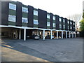
Rear of Willowbank hotel
The enormous 2-story 1960s extension with car parking underneath it behind the hotel in Wilmslow Road.
Note: Once a Best Western, this is now a "Hallmark" hotel, having been re-branded
Image: © Bob Harvey
Taken: 23 Apr 2015
0.14 miles
7
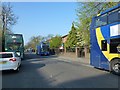
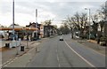
Lots of buses
Morning rush-hour traffic consisting largely of buses.
The blue Magic Bus in the midground was sitting 'out of service' with hazard flashers on in the bus lane.
Image: © Bob Harvey
Taken: 23 Apr 2015
0.14 miles
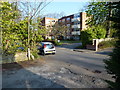
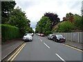
10
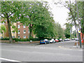
Junction of Whiteoak Road and Wilmslow Road
Wilmslow Road runs across the foreground.
Image: © Slbs
Taken: Unknown
0.15 miles