1
Memorial stone at Luther King House
The Luther King House Educational Trust has its facilities and staff on the Luther King House site in Brighton Grove, Manchester
Image: © David Smith
Taken: 4 Jul 2009
0.01 miles
2
Chapel: Luther King House
Image: © John H Darch
Taken: 8 Sep 2010
0.04 miles
3
The courtyard of Luther King House
The Luther King House Educational Trust has its facilities and staff on the Luther King House site in Brighton Grove, Manchester
Image: © David Smith
Taken: 4 Jul 2009
0.06 miles
4
St James' House
The former St James' Church at Danes Road, Rusholme. The church was established in 1595. This building was opened in 1846 and closed in 1981. It is now in use as a care home (http://www.carehome.co.uk/carehome.cfm/searchazref/10003503STJA )
The building is Grade II listed.
Image: © David Dixon
Taken: 28 Sep 2011
0.12 miles
5
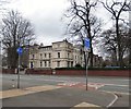
Brighton House
The large house in the once fashionable area of Brighton Grove, Rusholme, is now the offices of Abbey Solicitors.
Image: © Gerald England
Taken: 11 Mar 2017
0.12 miles
6
St James House
formerly a church, this building in Danes Road is now a residential home
Image: © Daniel P Short
Taken: 20 Aug 2005
0.12 miles
7
The former church of St James, Rusholme
The present building was built in 1845-46 to replace the earlier chapel of 1595. The architect was J.M. Derick and it is in Gothic revival style. The church closed for worship in 1979 and is now St James House Care Home.
Image: © Rod Allday
Taken: 12 Apr 2014
0.12 miles
8
Playing field
The playing fields at Manchester Grammar School
Image: © Bob Harvey
Taken: 11 Jun 2014
0.12 miles
9
Birchfields Park, Rusholme
The Birch Road entrance to Birchfields Park.
Birchfields Park was acquired by Manchester City Council in 1887 from local landowner Sir William Anson for the creation of a public park, and formally opened by Prince Albert in 1888.
The site's main landscape elements include a large area of amenity grassland enclosed by mature woodland, trees in grass, unimproved grassland, a wildflower meadow and a woodland garden.
http://webarchive.nationalarchives.gov.uk/20110928051116/http://www.manchester.gov.uk/info/200073/parks_and_open_spaces/1476/birchfields_park/1 - Manchester City Council (about Birchfields Park)
Image: © David Dixon
Taken: 28 Sep 2011
0.14 miles
10
Moon Grove, Manchester
"A charming little enclave off Dickenson Road with small Late Georgian houses, built as a speculation in the 1830s."
Image: © Stephen Richards
Taken: 12 Jun 2016
0.15 miles


