1
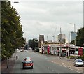
Windows, white vans and winter sunlight
University of Manchester, Jean McFarlane Building
Image: © David Martin
Taken: 14 Dec 2017
0.03 miles
2
Alan Turing Building, Manchester University
The University of Manchester's School of Mathematics is situated here.
Image: © Bradley Michael
Taken: 7 Jul 2015
0.04 miles
3
University of Manchester - Alan Turing Building
Image: © N Chadwick
Taken: 17 Dec 2011
0.04 miles
4
Walkway in the Alan Turing Building at the University of Manchester
The Alan Turing Building houses the School of Mathematics.
Image: © Graham Hogg
Taken: 9 May 2012
0.05 miles
5
Roscoe Building, Brunswick Street, Manchester
One of a group of buildings dating from a phase of the University of Manchester's expansion in 1957-67. Most are brick with copper cladding, but it is conspicuous in its use of white concrete, the favoured material of local firm, Cruickshank & Seward, 1964.
It houses the International Centre for Labour Studies, and is named after Henry Roscoe, a chemist "particularly noted for early work on vanadium and for photochemical studies".
Image: © Stephen Richards
Taken: 23 Jul 2011
0.05 miles
6
University of Manchester
Image: © N Chadwick
Taken: 17 Dec 2011
0.06 miles
7
Schuster Building, Brunswick Street, Manchester
One of a group of similarly-styled buildings dating from a phase of the University of Manchester's expansion in 1957-67. They are brick with liberal use of copper cladding, and most were designed by Harry S. Fairhurst & Son.
It houses the School of Physics and Astronomy. The octagonal building, which I think is a lecture theatre, is crowned by a sculpture by Michael Piper.
Image: © Stephen Richards
Taken: 23 Jul 2011
0.06 miles
8
Upper Brook Street
The A34 into Manchester. Behind the Citroen dealers can be seen a glimpse of the Unitarian Chapel.
Image: © Gerald England
Taken: 2 Aug 2010
0.08 miles
9
Upper Brook Street Unitarian Chapel
Viewed from the top floor of the Aquatics Centre Car Park.
Image: © Keith Williamson
Taken: 18 Oct 2010
0.08 miles
10
University of Manchester, Williamson Building
The Williamson Building is located on Oxford Road at the corner with Brunswick Street. It houses the Williamson Research Centre, a range of research laboratories and equipment for investigating our environment and the effect of human behaviour upon environmental systems. The building is part of Manchester University and is one of a number of similar-styled buildings dating from the university’s expansion in the first half of the 1960s and is named for Professor William Crawford Williamson FRS, the eminent Victorian scientist who was appointed as the first Professor of Natural History (Geology, Zoology and Botany) at Manchester in 1851.
Image: © David Dixon
Taken: 31 Jul 2018
0.08 miles


