IMAGES TAKEN NEAR TO
Barbara Castle Square, MANCHESTER, M13 9HW

Introduction

This page details the photographs taken nearby to Barbara Castle Square, M13 9HW by members of the Geograph project.

The Geograph project started in 2005 with the aim of publishing, organising and preserving representative images for every square kilometre of Great Britain, Ireland and the Isle of Man.

There are currently over 7.5m images from over14,400 individuals and you can help contribute to the project by visiting https://www.geograph.org.uk

Image Map


Images are licensed for reuse under creativecommons.org/licenses/by-sa/2.0
Notes
  • Clicking on the map will re-center to the selected point.
  • The higher the marker number, the further away the image location is from the centre of the postcode.

Image Listing (37 Images Found)

Images are licensed for reuse under creativecommons.org/licenses/by-sa/2.0
  • ...
Image
Details
Distance
1
Amid the demolition work.
Guidepost Square, off Devonshire Street South, Ardwick, sits in an area being demolished prior to redevelopment.
Image: © Keith Williamson Taken: 2 Sep 2005
0.04 miles
2
St Luke the Physician, Longsight
Church and neighbourhood centre, Devonshire Street South, Longsight.
Image: © David Dixon Taken: 19 May 2010
0.07 miles
3
Shops on Stockport Road
Automoney, Nisa Local, Subway, Cash Generator, Greggs and the Salvation Army. The empty shop next to Cash Generator used to be Grove Village Pharmacy.
Image: © Gerald England Taken: 29 Jan 2018
0.07 miles
4
Stockport Road
The A6 passing the shops servicing Grove Village Image The buses are on the busy route 192.
Image: © Gerald England Taken: 29 Jan 2018
0.08 miles
5
Stockport Road
The A6 between Ardwick and Longsight.
Image: © Gerald England Taken: 29 Jan 2018
0.09 miles
6
Manchester from the air
Looking over the hospitals at Upper Brook Street towards Manchester Piccadilly railway station and the city centre from a Prague bound flight from Manchester.
Image: © Thomas Nugent Taken: 6 Jul 2020
0.10 miles
7
Ardwick Green McDonald's
On Stockport Road.
Image: © Gerald England Taken: 15 Sep 2014
0.12 miles
8
Longsight Post Office
The post office and sorting office on Stockport Road.
Image: © David Dixon Taken: 19 May 2010
0.13 miles
9
A Manchester bus in Stockport Road
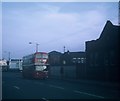
Taken in October 1969, this photo shows a 1964 Daimler Fleetline with Metro- Cammell 76-seater bodywork operated by Manchester City Transport in Stockport Road. It is working route 94 from Southern Cemetery to Levenshulme (Lloyd Road) via Old Trafford and City Centre. An MCT bus stop can be seen to the right of the vehicle. This area has changed considerably in the intervening decades.
Image: © David Hillas Taken: 12 Oct 1969
0.13 miles
10
Hellidon Close
The entrance to Cariocca Business Park off Devonshire Street.
Image: © Gerald England Taken: 29 Jan 2018
0.16 miles
  • ...